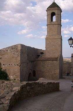
Forès
| Forès | ||
|---|---|---|
| Municipality | ||
 | ||
| ||
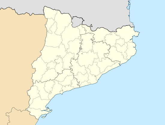 Forès Location in Catalonia | ||
| Coordinates: 41°29′38″N 1°14′17″E / 41.494°N 1.238°ECoordinates: 41°29′38″N 1°14′17″E / 41.494°N 1.238°E | ||
| Country |
| |
| Autonomous community |
| |
| Province |
| |
| Comarca |
| |
| Government | ||
| • Mayor | Julià Josep Plaza Briansó (2015)[1] | |
| Area[2] | ||
| • Total | 16.0 km2 (6.2 sq mi) | |
| Population (2014)[1] | ||
| • Total | 46 | |
| • Density | 2.9/km2 (7.4/sq mi) | |
| Time zone | CET (UTC+1) | |
| • Summer (DST) | CEST (UTC+2) | |
| Website |
www | |
Forès is a municipality and village in the comarca of Conca de Barberà in the Province of Tarragona in Catalonia, Spain.
References
- 1 2 "Ajuntament de Forès". Generalitat of Catalonia. Retrieved 2015-11-13.
- ↑ "El municipi en xifres: Forès". Statistical Institute of Catalonia. Retrieved 2015-11-23.
External links
- Official website
- Generalitat of Catalonia - data
- Statistical Institute of Catalonia - The municipality in figures
 |
Passanant i Belltall | |
Conesa | |
| |
||||
| ||||
| | ||||
| Solivella | Sarral | Rocafort de Queralt |
Municipalities of Conca de Barberà | ||
|---|---|---|
This article is issued from Wikipedia - version of the 1/25/2016. The text is available under the Creative Commons Attribution/Share Alike but additional terms may apply for the media files.