Estables
| Estables | |
|---|---|
|
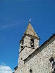
The bell tower of the church in Estables | |
 Estables | |
|
Location within Occitanie region  Estables | |
| Coordinates: 44°40′11″N 3°29′16″E / 44.6697°N 3.4878°ECoordinates: 44°40′11″N 3°29′16″E / 44.6697°N 3.4878°E | |
| Country | France |
| Region | Occitanie |
| Department | Lozère |
| Arrondissement | Mende |
| Canton | Saint-Amans |
| Intercommunality | Terre de Randon |
| Government | |
| • Mayor (2008–2014) | André Viala[1] |
| Area1 | 32.89 km2 (12.70 sq mi) |
| Population (1999)2 | 171 |
| • Density | 5.2/km2 (13/sq mi) |
| Time zone | CET (UTC+1) |
| • Summer (DST) | CEST (UTC+2) |
| INSEE/Postal code | 48057 / 48700 |
| Elevation |
1,090–1,553 m (3,576–5,095 ft) (avg. 1,200 m or 3,900 ft) |
|
1 French Land Register data, which excludes lakes, ponds, glaciers > 1 km² (0.386 sq mi or 247 acres) and river estuaries. 2 Population without double counting: residents of multiple communes (e.g., students and military personnel) only counted once. | |
Estables is a village and commune in the Lozère department in southern France.
Geography
The Chapeauroux has its source in the commune's south-eastern part.
See also
References
External links
| Wikimedia Commons has media related to Estables. |
This article is issued from Wikipedia - version of the 1/3/2016. The text is available under the Creative Commons Attribution/Share Alike but additional terms may apply for the media files.