Entrammes
| Entrammes | ||
|---|---|---|
|
The new Town Hall in Entrammes | ||
| ||
 Entrammes | ||
|
Location within Pays de la Loire region 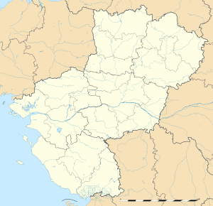 Entrammes | ||
| Coordinates: 47°59′48″N 0°42′45″W / 47.9967°N 0.7125°WCoordinates: 47°59′48″N 0°42′45″W / 47.9967°N 0.7125°W | ||
| Country | France | |
| Region | Pays de la Loire | |
| Department | Mayenne | |
| Arrondissement | Laval | |
| Canton | Laval-Est | |
| Government | ||
| • Mayor (2008–2014) | Jean Bodin | |
| Area1 | 26.16 km2 (10.10 sq mi) | |
| Population (2006)2 | 2,076 | |
| • Density | 79/km2 (210/sq mi) | |
| Time zone | CET (UTC+1) | |
| • Summer (DST) | CEST (UTC+2) | |
| INSEE/Postal code | 53094 / 53260 | |
| Elevation |
33–108 m (108–354 ft) (avg. 50 m or 160 ft) | |
|
1 French Land Register data, which excludes lakes, ponds, glaciers > 1 km² (0.386 sq mi or 247 acres) and river estuaries. 2 Population without double counting: residents of multiple communes (e.g., students and military personnel) only counted once. | ||


Entrammes is a commune in the Mayenne department in north-western France. It is located about 3.7 kilometres (2.3 mi) west of Parné-sur-Roc and about 3.7 kilometres (2.3 mi) south of Laval Entrammes Airport in Laval.[1]
History
Entrammes owes its location to a major ford across the Mayenne River: the road connecting Le Mans to Rennes traditionally crossed the river here. Consequently, a substantial town covering approximately 55 hectares existed here already two thousand years ago, and was already settled during the first century BC.
Gallery
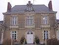 The old Town Hall
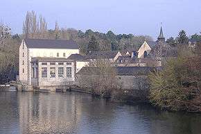
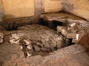 The Roman-Gaul Baths
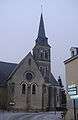 The parish church
See also
References
- ↑ Maps, Weather, and Airports for Entrammes, France, retrieved 5 April 2010
| Wikimedia Commons has media related to Entrammes. |
This article is issued from Wikipedia - version of the 8/16/2016. The text is available under the Creative Commons Attribution/Share Alike but additional terms may apply for the media files.