Aurec-sur-Loire
| Aurec-sur-Loire | ||
|---|---|---|
|
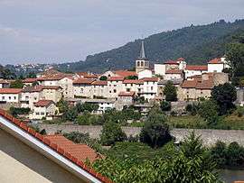
A general view of Aurec-sur-Loire | ||
| ||
 Aurec-sur-Loire | ||
|
Location within Auvergne-Rhône-Alpes region  Aurec-sur-Loire | ||
| Coordinates: 45°22′12″N 4°12′09″E / 45.37°N 4.2025°ECoordinates: 45°22′12″N 4°12′09″E / 45.37°N 4.2025°E | ||
| Country | France | |
| Region | Auvergne-Rhône-Alpes | |
| Department | Haute-Loire | |
| Arrondissement | Yssingeaux | |
| Canton | Aurec-sur-Loire | |
| Intercommunality | Loire-Semène | |
| Government | ||
| • Mayor (2008–2014) | Claude Vial | |
| Area1 | 22.44 km2 (8.66 sq mi) | |
| Population (2009)2 | 5,557 | |
| • Density | 250/km2 (640/sq mi) | |
| Time zone | CET (UTC+1) | |
| • Summer (DST) | CEST (UTC+2) | |
| INSEE/Postal code | 43012 / 43110 | |
| Elevation |
414–821 m (1,358–2,694 ft) (avg. 432 m or 1,417 ft) | |
|
1 French Land Register data, which excludes lakes, ponds, glaciers > 1 km² (0.386 sq mi or 247 acres) and river estuaries. 2 Population without double counting: residents of multiple communes (e.g., students and military personnel) only counted once. | ||

Aurec-sur-Loire is a commune in the Haute-Loire department in south-central France.
Population
| Historical population | ||
|---|---|---|
| Year | Pop. | ±% |
| 1936 | 2,668 | — |
| 1954 | 2,745 | +2.9% |
| 1962 | 3,106 | +13.2% |
| 1968 | 3,620 | +16.5% |
| 1975 | 3,975 | +9.8% |
| 1982 | 4,248 | +6.9% |
| 1990 | 4,510 | +6.2% |
| 1999 | 4,895 | +8.5% |
| 2009 | 5,557 | +13.5% |
Galleries
-
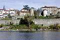
Ramparts.
-
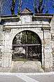
Former doorway to the Castle.
-
North face
-

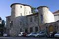
Tower of the Burgundians.
-
Nave.
-
Baptismal Fonts
-
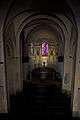
.jpg)
Altar and altarpiece.
-
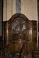
Pieta.
-
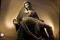
St. Peter.
-
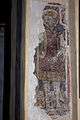
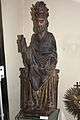
St. Michael.
See also
References
| Wikimedia Commons has media related to Aurec-sur-Loire. |
This article is issued from Wikipedia - version of the 10/19/2016. The text is available under the Creative Commons Attribution/Share Alike but additional terms may apply for the media files.