Montcalm, Quebec
Not to be confused with Montcalm Regional County Municipality, Quebec.
| Montcalm | |
|---|---|
| Municipality | |
|
Weir | |
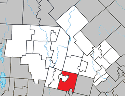 Location within Les Laurentides RCM | |
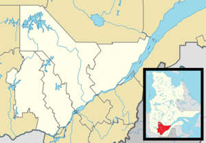 Montcalm Location in central Quebec | |
| Coordinates: 45°58′N 74°30′W / 45.967°N 74.500°WCoordinates: 45°58′N 74°30′W / 45.967°N 74.500°W[1] | |
| Country |
|
| Province |
|
| Region | Laurentides |
| RCM | Les Laurentides |
| Constituted | March 6, 1907 |
| Government[2] | |
| • Mayor | Steven Larose |
| • Federal riding | Laurentides—Labelle |
| • Prov. riding | Argenteuil |
| Area[2][3] | |
| • Total | 129.30 km2 (49.92 sq mi) |
| • Land | 117.18 km2 (45.24 sq mi) |
| Population (2011)[3] | |
| • Total | 619 |
| • Density | 5.3/km2 (14/sq mi) |
| • Pop 2006-2011 |
|
| • Dwellings | 663 |
| Time zone | EST (UTC−5) |
| • Summer (DST) | EDT (UTC−4) |
| Postal code(s) | J0T 2V0 |
| Area code(s) | 819 |
| Highways |
|
| Website |
www montcalm |
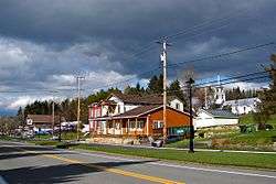
Montcalm is a municipality in the Les Laurentides Regional County Municipality of Quebec southeast of Mont-Tremblant. The main population centre in Montcalm is the village of Weir.
Demographics
Population trend:[4]
- Population in 2011: 619 (2006 to 2011 population change: -5.1 %)
- Population in 2006: 652
- Population in 2001: 534
- Population in 1996: 449
- Population in 1991: 369
Private dwellings occupied by usual residents: 308 (total dwellings: 663)
Mother tongue:
- English as first language: 25%
- French as first language: 73.5%
- English and French as first language: 1.5%
- Other as first language: 0%
Weir
Weir (45°56′42″N 74°32′58″W / 45.94500°N 74.54944°W) is an unincorporated village in Montcalm, accessible via Quebec Route 364. It is home to a satellite earth station for VSNL International Canada.
Weir is named after William Alexander Weir (1858-1929), a Quebec politician and judge.[5]
References
- ↑ Reference number 274200 of the Commission de toponymie du Québec (French)
- 1 2 Geographic code 78055 in the official Répertoire des municipalités (French)
- 1 2 "(Code 2478055) Census Profile". 2011 census. Statistics Canada. 2012.
- ↑ Statistics Canada: 1996, 2001, 2006, 2011 census
- ↑ Commission de toponymie du Quebec - Weir
External links
 Media related to Montcalm, Laurentides, Quebec at Wikimedia Commons
- Municipalité de Montcalm
- Atlas of Canada - Montcalm
- Commission de toponymie du Quebec
 |
Mont-Tremblant | Saint-Faustin–Lac-Carré | Sainte-Agathe-des-Monts | |
| Arundel, Barkmere | |
St-Adolphe-d'Howard | ||
| ||||
| | ||||
| Harrington | Wentworth-Nord / Lac-des-Seize-Îles |
| Cities/towns | |
|---|---|
| Municipalities | |
| Townships | |
| Parishes | |
| Villages | |
| |
This article is issued from Wikipedia - version of the 12/20/2013. The text is available under the Creative Commons Attribution/Share Alike but additional terms may apply for the media files.