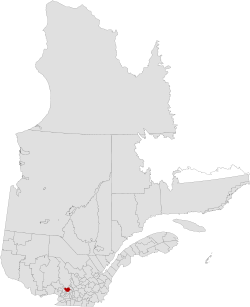
Montcalm Regional County Municipality
| Montcalm | |
|---|---|
| Regional county municipality | |
 | |
| Coordinates: 45°54′N 73°40′W / 45.900°N 73.667°WCoordinates: 45°54′N 73°40′W / 45.900°N 73.667°W[1] | |
| Country |
|
| Province |
|
| Region | Lanaudière |
| Effective | January 1, 1982 |
| County seat | Sainte-Julienne |
| Government[2] | |
| • Type | Prefecture |
| • Prefect | Danielle Henri Allard |
| Area[2][3] | |
| • Total | 716.30 km2 (276.56 sq mi) |
| • Land | 711.59 km2 (274.75 sq mi) |
| Population (2011)[3] | |
| • Total | 48,378 |
| • Density | 68.0/km2 (176/sq mi) |
| • Pop 2006–2011 |
|
| • Dwellings | 21,430 |
| Time zone | EST (UTC−5) |
| • Summer (DST) | EDT (UTC−4) |
| Area code(s) | 450 and 579 |
| Website |
www |
Montcalm is a regional county municipality in the Lanaudière region of Quebec, Canada. Its seat is Sainte-Julienne.
The population according to the Canada 2011 Census is 48,378[3]
Subdivisions
There are 10 subdivisions within the RCM:[2]
|
|
|
Transportation
Access Routes
Highways and numbered routes that run through the municipality, including external routes that start or finish at the county border:[4]
|
|
See also
References
External links
 |
Matawinie RCM | | ||
| La Rivière-du-Nord RCM | |
Joliette RCM L'Assomption RCM | ||
| ||||
| | ||||
| Les Moulins RCM |
| Regional county municipalities and equivalent territories | |
|---|---|
| Municipalities | |
This article is issued from Wikipedia - version of the 2/17/2014. The text is available under the Creative Commons Attribution/Share Alike but additional terms may apply for the media files.