Maconacon, Isabela
| Maconacon | |
|---|---|
| Municipality | |
|
Aerial view of Maconacon after Typhoon Megi (2010) | |
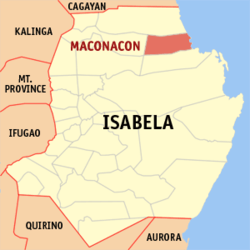 Map of Isabela showing the location of Maconacon | |
.svg.png) Maconacon Location within the Philippines | |
| Coordinates: 17°26′N 122°14′E / 17.433°N 122.233°ECoordinates: 17°26′N 122°14′E / 17.433°N 122.233°E | |
| Country | Philippines |
| Region | Cagayan Valley (Region II) |
| Province | Isabela |
| District | 1st District, Isabela |
| Barangays | 10 |
| Government[1] | |
| • Mayor | Lycelle Kate M. Domingo |
| Area[2] | |
| • Total | 538.66 km2 (207.98 sq mi) |
| Population (2010)[3] | |
| • Total | 3,615 |
| • Density | 6.7/km2 (17/sq mi) |
| Time zone | PST (UTC+8) |
| ZIP code | 3333 |
| Dialing code | +63 (0)78 |
| Income class | 3rd class; rural |

Maconacon is a third class municipality in the province of Isabela, Philippines. According to the 2010 census, it had a population of 3,615 people, making it the least populous municipality in the province.[3]
Barangays
Maconacon is politically subdivided into 10 barangays.[2]
- Diana
- Eleonor (Pob.)
- Fely (Pob.)
- Lita (Pob.)
- Reina Mercedes
- Minanga
- Malasin
- Canadam
- Aplaya
- Santa Marina (Dianggo)
Demographics
| Population census of Maconacon | ||
|---|---|---|
| Year | Pop. | ±% p.a. |
| 1990 | 7,259 | — |
| 1995 | 5,895 | −3.82% |
| 2000 | 3,721 | −9.39% |
| 2007 | 3,991 | +0.97% |
| 2010 | 3,615 | −3.54% |
| 2015 | 4,253 | +3.14% |
| Source: National Statistics Office[3] | ||
Transportation
Maconacon is accessible via land and air. Its primary gateway is Maconacon Airport which connects this isolated town to Cauayan Airport, also in Isabela.
Climate
| Climate data for Maconacon, Isabela | |||||||||||||
|---|---|---|---|---|---|---|---|---|---|---|---|---|---|
| Month | Jan | Feb | Mar | Apr | May | Jun | Jul | Aug | Sep | Oct | Nov | Dec | Year |
| Average high °C (°F) | 29 (84) |
30 (86) |
32 (90) |
35 (95) |
35 (95) |
35 (95) |
34 (93) |
33 (91) |
32 (90) |
31 (88) |
30 (86) |
28 (82) |
32 (89.6) |
| Average low °C (°F) | 19 (66) |
20 (68) |
21 (70) |
23 (73) |
23 (73) |
24 (75) |
23 (73) |
23 (73) |
23 (73) |
22 (72) |
21 (70) |
20 (68) |
21.8 (71.2) |
| Average precipitation mm (inches) | 31.2 (1.228) |
23 (0.91) |
27.7 (1.091) |
28.1 (1.106) |
113.5 (4.469) |
141.4 (5.567) |
176.4 (6.945) |
236.6 (9.315) |
224.9 (8.854) |
247.7 (9.752) |
222.9 (8.776) |
178 (7.01) |
1,651.4 (65.023) |
| Average rainy days | 10 | 6 | 5 | 5 | 13 | 12 | 15 | 15 | 15 | 17 | 16 | 15 | 144 |
| Source: World Weather Online[4] | |||||||||||||
References
- ↑ "Official City/Municipal 2013 Election Results". Intramuros, Manila, Philippines: Commission on Elections (COMELEC). 11 September 2013. Retrieved 9 January 2014.
- 1 2 "Province: ISABELA". PSGC Interactive. Makati City, Philippines: National Statistical Coordination Board. Retrieved 9 January 2014.
- 1 2 3 "Total Population by Province, City, Municipality and Barangay: as of May 1, 2010" (PDF). 2010 Census of Population and Housing. National Statistics Office. Retrieved 9 January 2014.
- ↑ "Maconacon, Isabela: Average Temperatures and Rainfall". World Weather Online. Retrieved 3 November 2015.
External links
| Wikimedia Commons has media related to Maconacon. |
- Philippine Standard Geographic Code
- Philippine Census Information
- Municipality of Maconacon
- Local Governance Performance Management System
 |
Peñablanca, Cagayan | | ||
| San Pablo Cabagan |
|
Pacific Ocean | ||
| ||||
| | ||||
| Tumauini | Divilacan |
Ilagan (capital) | |
| Municipalities |
|
| Component Cities | |
| Independent Component City |
|
| Barangays | |
This article is issued from Wikipedia - version of the 12/1/2016. The text is available under the Creative Commons Attribution/Share Alike but additional terms may apply for the media files.