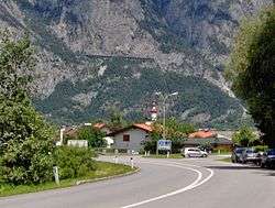
Kematen in Tirol
| Kematen in Tirol | ||
|---|---|---|
 | ||
| ||
 Kematen in Tirol Location within Austria | ||
| Coordinates: 47°15′15″N 11°16′20″E / 47.25417°N 11.27222°ECoordinates: 47°15′15″N 11°16′20″E / 47.25417°N 11.27222°E | ||
| Country | Austria | |
| State | Tyrol | |
| District | Innsbruck Land | |
| Government | ||
| • Mayor | Rudolf Häusler | |
| Area | ||
| • Total | 6.99 km2 (2.70 sq mi) | |
| Elevation | 610 m (2,000 ft) | |
| Population (1 January 2016)[1] | ||
| • Total | 2,834 | |
| • Density | 410/km2 (1,100/sq mi) | |
| Time zone | CET (UTC+1) | |
| • Summer (DST) | CEST (UTC+2) | |
| Postal code | 6175 | |
| Area code | 05232 | |
| Vehicle registration | IL | |
| Website | www.kematen.org | |

Kematen in Tirol is a municipality in the district Innsbruck-Land located about 12 km west of Innsbruck. The Melach river flows into the Inn river in Kematen. Kematen was first mentioned as „Caminata“ around 600.
Population
| Historical population | ||
|---|---|---|
| Year | Pop. | ±% |
| 1869 | 586 | — |
| 1880 | 534 | −8.9% |
| 1890 | 506 | −5.2% |
| 1900 | 546 | +7.9% |
| 1910 | 654 | +19.8% |
| 1923 | 601 | −8.1% |
| 1934 | 649 | +8.0% |
| 1939 | 708 | +9.1% |
| 1951 | 2,180 | +207.9% |
| 1961 | 1,550 | −28.9% |
| 1971 | 1,650 | +6.5% |
| 1981 | 2,100 | +27.3% |
| 1991 | 2,258 | +7.5% |
| 2001 | 2,582 | +14.3% |
| 2011 | 2,571 | −0.4% |
References
External links
-
 Media related to Kematen in Tirol at Wikimedia Commons
This article is issued from Wikipedia - version of the 6/13/2016. The text is available under the Creative Commons Attribution/Share Alike but additional terms may apply for the media files.