Inchy-en-Artois
| Inchy-en-Artois | |
|---|---|
|
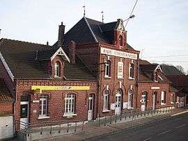
Town hall | |
 Inchy-en-Artois | |
|
Location within Hauts-de-France region  Inchy-en-Artois | |
| Coordinates: 50°10′49″N 3°03′09″E / 50.1803°N 3.0525°ECoordinates: 50°10′49″N 3°03′09″E / 50.1803°N 3.0525°E | |
| Country | France |
| Region | Hauts-de-France |
| Department | Pas-de-Calais |
| Arrondissement | Arras |
| Canton | Marquion |
| Intercommunality | Communauté de communes de Marquion |
| Government | |
| • Mayor (2008–2014) | Michel Rousseau |
| Area1 | 11.06 km2 (4.27 sq mi) |
| Population (2006)2 | 571 |
| • Density | 52/km2 (130/sq mi) |
| Time zone | CET (UTC+1) |
| • Summer (DST) | CEST (UTC+2) |
| INSEE/Postal code | 62469 / 62860 |
| Elevation |
48–97 m (157–318 ft) (avg. 54 m or 177 ft) |
|
1 French Land Register data, which excludes lakes, ponds, glaciers > 1 km² (0.386 sq mi or 247 acres) and river estuaries. 2 Population without double counting: residents of multiple communes (e.g., students and military personnel) only counted once. | |
Inchy-en-Artois is a commune in the Pas-de-Calais department in the Hauts-de-France region of France.
Geography
Inchy-en-Artois is a farming village situated 17 miles (27 km) southeast of Arras, at the junction of the D19 and the D22 roads.
Population
| Year | 1962 | 1968 | 1975 | 1982 | 1990 | 1999 | 2006 |
|---|---|---|---|---|---|---|---|
| Population | 610 | 595 | 576 | 534 | 576 | 556 | 571 |
| From the year 1962 on: No double counting—residents of multiple communes (e.g. students and military personnel) are counted only once. | |||||||
Places of interest
- The church of St.Martin, rebuilt along with all of the village, after the First World War.
- The Commonwealth War Graves Commission cemetery.
See also
References
External links
| Wikimedia Commons has media related to Inchy-en-Artois. |
This article is issued from Wikipedia - version of the 11/6/2016. The text is available under the Creative Commons Attribution/Share Alike but additional terms may apply for the media files.