Château-Ville-Vieille
| Château-Ville-Vieille | ||
|---|---|---|
|
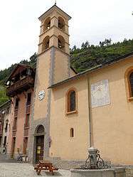
Chateau of Queyras | ||
| ||
 Château-Ville-Vieille | ||
|
Location within Provence-A.-C.d'A. region 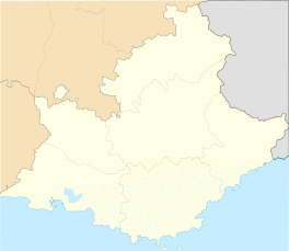 Château-Ville-Vieille | ||
| Coordinates: 44°45′27″N 6°47′30″E / 44.7575°N 6.7917°ECoordinates: 44°45′27″N 6°47′30″E / 44.7575°N 6.7917°E | ||
| Country | France | |
| Region | Provence-Alpes-Côte d'Azur | |
| Department | Hautes-Alpes | |
| Arrondissement | Briançon | |
| Canton | Aiguilles | |
| Intercommunality | Queyras | |
| Government | ||
| • Mayor (2008–2014) | Jean-Louis Poncet | |
| Area1 | 66.9 km2 (25.8 sq mi) | |
| Population (2008)2 | 328 | |
| • Density | 4.9/km2 (13/sq mi) | |
| Time zone | CET (UTC+1) | |
| • Summer (DST) | CEST (UTC+2) | |
| INSEE/Postal code | 05038 / 05350 | |
| Elevation |
1,229–3,280 m (4,032–10,761 ft) (avg. 1,360 m or 4,460 ft) | |
|
1 French Land Register data, which excludes lakes, ponds, glaciers > 1 km² (0.386 sq mi or 247 acres) and river estuaries. 2 Population without double counting: residents of multiple communes (e.g., students and military personnel) only counted once. | ||

Château-Ville-Vieille is a commune in the Hautes-Alpes department in southeastern France.
Geography
The commune is located in the Queyras.
The two villages in the commune lie in the Guil valley; Ville-Vieille on the left bank of the Guil and Château-Queyras on its right bank.
Population
| Historical population | ||
|---|---|---|
| Year | Pop. | ±% |
| 1962 | 295 | — |
| 1968 | 304 | +3.1% |
| 1975 | 283 | −6.9% |
| 1982 | 268 | −5.3% |
| 1990 | 271 | +1.1% |
| 1999 | 321 | +18.5% |
| 2008 | 328 | +2.2% |
See also
References
| Wikimedia Commons has media related to Château-Ville-Vieille. |
This article is issued from Wikipedia - version of the 2/18/2014. The text is available under the Creative Commons Attribution/Share Alike but additional terms may apply for the media files.