Carrascalejo
- Not to be confused with El Carrascalejo
| Carrascalejo | ||
|---|---|---|
| Municipality | ||
|
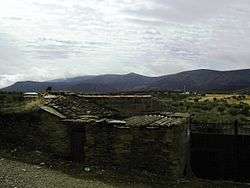
Carrascalejo with the Sierra de Altamira in the background | ||
| ||
 Carrascalejo Location in Spain | ||
| Coordinates: 39°38′N 5°13′W / 39.633°N 5.217°W | ||
| Country | Spain | |
| Autonomous community | Extremadura | |
| Province | Cáceres | |
| Municipality | Carrascalejo | |
| Area | ||
| • Total | 48 km2 (19 sq mi) | |
| Elevation | 607 m (1,991 ft) | |
| Population (2014) | ||
| • Total | 273 | |
| Time zone | CET (UTC+1) | |
| • Summer (DST) | CEST (UTC+2) | |
.svg.png)
Carrascalejo is a municipality located in the province of Cáceres, Extremadura, Spain. According to the 2014 census,[1] the municipality has a population of 273 inhabitants.
References
External links
 Media related to Carrascalejo at Wikimedia Commons
This article is issued from Wikipedia - version of the 1/24/2016. The text is available under the Creative Commons Attribution/Share Alike but additional terms may apply for the media files.