Beaumont, Belgium
| Beaumont | |||
|---|---|---|---|
| Municipality | |||
 | |||
| |||
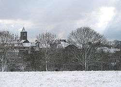
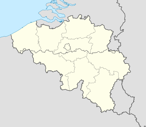 Beaumont Location in Belgium | |||
|
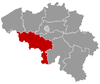
Location of Beaumont in Hainaut 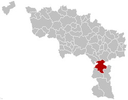 | |||
| Coordinates: 50°14′N 04°14′E / 50.233°N 4.233°ECoordinates: 50°14′N 04°14′E / 50.233°N 4.233°E | |||
| Country | Belgium | ||
| Community | French Community | ||
| Region | Wallonia | ||
| Province | Hainaut | ||
| Arrondissement | Thuin | ||
| Government | |||
| • Mayor | Charles Dupuis | ||
| • Governing party/ies | ICI | ||
| Area | |||
| • Total | 92.97 km2 (35.90 sq mi) | ||
| Population (1 January 2016)[1] | |||
| • Total | 7,052 | ||
| • Density | 76/km2 (200/sq mi) | ||
| Postal codes | 6500, 6511 | ||
| Area codes | 071 | ||
| Website | www.beaumont.be | ||


Beaumont (French pronunciation: [bo.mɔ̃]) is a Walloon municipality located in the Belgian province of Hainaut, on the border with France. On January 1, 2012, Beaumont had a total population of 7,060. The total area is 92.97 km².
The municipality consists of the following sub-municipalities: Beaumont proper, Barbençon, Leugnies, Leval-Chaudeville, Renlies, Solre-Saint-Géry, Thirimont, and Strée.
The Tour Salamandre, an 11th-century donjon, is the most remarkable remains of the ancient fortifications of Beaumont.
Gallery
-

Tour Salamandre
-
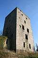
Tour Salamandre
-
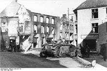
View of Beaumont after its capture by German troops in 1940
References
- ↑ Population per municipality as of 1 January 2016 (XLS; 397 KB)
External links
-
 Media related to Beaumont, Belgium at Wikimedia Commons
 |
Erquelinnes | Merbes-le-Château, Thuin | | |
| Bousignies-sur-Roc (FR-59) Cousolre (FR-59) |
|
Walcourt (WNA) Froidchapelle | ||
| ||||
| | ||||
| Sivry-Rance |
This article is issued from Wikipedia - version of the 11/30/2016. The text is available under the Creative Commons Attribution/Share Alike but additional terms may apply for the media files.