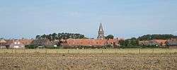
Zuienkerke
| Zuienkerke | |||
|---|---|---|---|
| Municipality | |||
 | |||
| |||
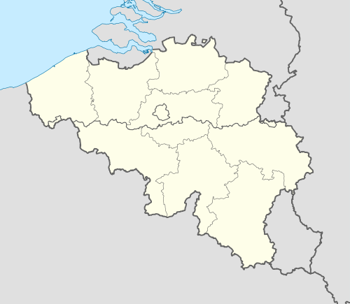 Zuienkerke Location in Belgium | |||
|
Location of Zuienkerke in West Flanders 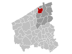 | |||
| Coordinates: 51°15′N 03°09′E / 51.250°N 3.150°ECoordinates: 51°15′N 03°09′E / 51.250°N 3.150°E | |||
| Country | Belgium | ||
| Community | Flemish Community | ||
| Region | Flemish Region | ||
| Province | West Flanders | ||
| Arrondissement | Bruges | ||
| Government | |||
| • Mayor | Dhr. Alain De Vlieghe | ||
| • Governing party/ies | LB | ||
| Area | |||
| • Total | 48.86 km2 (18.86 sq mi) | ||
| Population (1 January 2016)[1] | |||
| • Total | 2,711 | ||
| • Density | 55/km2 (140/sq mi) | ||
| Postal codes | 8377 | ||
| Area codes | 050 | ||
| Website | www.zuienkerke.be | ||


Zuienkerke (Dutch pronunciation: [ˈzœy̯əŋkɛrkə]) is a municipality located in the Belgian province of West Flanders. The municipality comprises the towns of Houtave, Meetkerke, Nieuwmunster and Zuienkerke proper. On January 1, 2006, Zuienkerke had a total population of 2,776. The total area is 48.86 km² which gives a population density of 57 inhabitants per km².
References
- ↑ Population per municipality as of 1 January 2016 (XLS; 397 KB)
External links
 Media related to Zuienkerke at Wikimedia Commons
- Official website - Available only in Dutch
 |
Blankenberge | | ||
| De Haan | |
Bruges | ||
| ||||
| | ||||
| Jabbeke |

This article is issued from Wikipedia - version of the 12/1/2016. The text is available under the Creative Commons Attribution/Share Alike but additional terms may apply for the media files.