Dentergem
| Dentergem | |||
|---|---|---|---|
| Municipality | |||
|
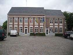
Dentergem town hall | |||
| |||
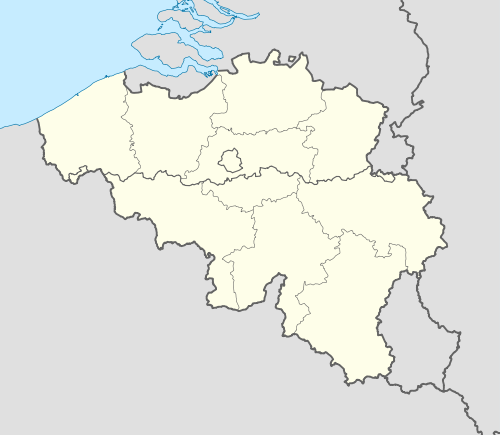 Dentergem Location in Belgium | |||
|
Location of Dentergem in West Flanders 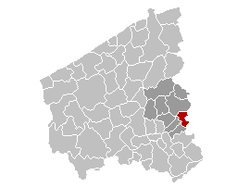 | |||
| Coordinates: 50°57′N 03°25′E / 50.950°N 3.417°ECoordinates: 50°57′N 03°25′E / 50.950°N 3.417°E | |||
| Country | Belgium | ||
| Community | Flemish Community | ||
| Region | Flemish Region | ||
| Province | West Flanders | ||
| Arrondissement | Tielt | ||
| Government | |||
| • Mayor | Koenraad Degroote | ||
| • Governing party/ies | Eendracht | ||
| Area | |||
| • Total | 25.94 km2 (10.02 sq mi) | ||
| Population (1 January 2016)[1] | |||
| • Total | 8,374 | ||
| • Density | 320/km2 (840/sq mi) | ||
| Postal codes | 8720 | ||
| Area codes | 051 - 056 - 09 | ||
| Website | www.dentergem.be | ||

Dentergem is a municipality located in the Belgian province of West Flanders. The municipality comprises the towns of Dentergem proper, Markegem, Oeselgem and Wakken. On January 1, 2006, Dentergem had a total population of 8,188. The total area is 25.94 km² which gives a population density of 316 inhabitants per km².
References
- ↑ Population per municipality as of 1 January 2016 (XLS; 397 KB)
External links
 Media related to Dentergem at Wikimedia Commons
- Official website - Available only in Dutch
 |
Tielt | | ||
| Oostrozebeke | |
Deinze (VOV) | ||
| ||||
| | ||||
| Wielsbeke | |
Zulte (VOV) |

This article is issued from Wikipedia - version of the 12/1/2016. The text is available under the Creative Commons Attribution/Share Alike but additional terms may apply for the media files.