Yamasá
| Yamasá | |
|---|---|
| Municipality | |
 Yamasá | |
| Coordinates: 18°46′N 70°01′W / 18.767°N 70.017°WCoordinates: 18°46′N 70°01′W / 18.767°N 70.017°W | |
| Country |
|
| Province | Monte Plata |
| Area[1] | |
| • Total | 441.61 km2 (170.51 sq mi) |
| Elevation[2] | 82 m (269 ft) |
| Population (2012) | |
| • Total | 57,982 |
| • Density | 130/km2 (340/sq mi) |
| Municipal Districts | 1 |
| Distance to – Santo Domingo |
42 km (26 mi) |
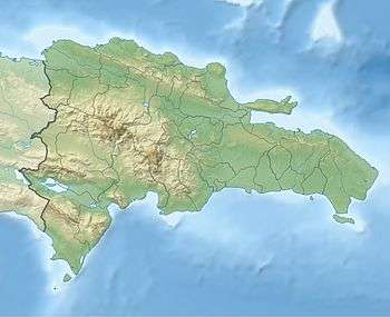
Yamasá is a municipality (municipio) of the Monte Plata province in the Dominican Republic. It includes the municipal district (distrito municipal) of Los Botados.[3] Yamasa is north of the capital city of Santo Domingo. The Rio Ozama, one of Dominican Republic's longest rivers, passes through Yamasa.
Climate
| Climate data for Yamasá (1961–1990) | |||||||||||||
|---|---|---|---|---|---|---|---|---|---|---|---|---|---|
| Month | Jan | Feb | Mar | Apr | May | Jun | Jul | Aug | Sep | Oct | Nov | Dec | Year |
| Record high °C (°F) | 35.0 (95) |
37.7 (99.9) |
36.7 (98.1) |
37.9 (100.2) |
38.7 (101.7) |
39.6 (103.3) |
39.4 (102.9) |
38.4 (101.1) |
38.4 (101.1) |
38.8 (101.8) |
37.0 (98.6) |
34.6 (94.3) |
39.6 (103.3) |
| Average high °C (°F) | 29.5 (85.1) |
30.3 (86.5) |
31.2 (88.2) |
32.0 (89.6) |
32.6 (90.7) |
33.1 (91.6) |
33.2 (91.8) |
32.9 (91.2) |
32.8 (91) |
32.5 (90.5) |
31.1 (88) |
29.9 (85.8) |
31.8 (89.2) |
| Average low °C (°F) | 18.9 (66) |
19.0 (66.2) |
19.7 (67.5) |
20.2 (68.4) |
20.9 (69.6) |
21.3 (70.3) |
21.5 (70.7) |
21.3 (70.3) |
21.1 (70) |
20.8 (69.4) |
20.2 (68.4) |
19.2 (66.6) |
20.3 (68.5) |
| Record low °C (°F) | 13.2 (55.8) |
13.7 (56.7) |
13.5 (56.3) |
13.5 (56.3) |
15.5 (59.9) |
16.2 (61.2) |
16.3 (61.3) |
15.7 (60.3) |
15.5 (59.9) |
15.3 (59.5) |
13.8 (56.8) |
10.6 (51.1) |
10.6 (51.1) |
| Average rainfall mm (inches) | 90.0 (3.543) |
95.1 (3.744) |
101.7 (4.004) |
161.6 (6.362) |
287.4 (11.315) |
246.9 (9.72) |
255.6 (10.063) |
326.6 (12.858) |
250.7 (9.87) |
245.3 (9.657) |
161.4 (6.354) |
121.8 (4.795) |
2,344.1 (92.287) |
| Average rainy days (≥ 1.0 mm) | 9.6 | 8.0 | 7.3 | 8.9 | 15.0 | 14.0 | 16.5 | 17.7 | 15.2 | 14.7 | 12.1 | 10.6 | 149.6 |
| Source: NOAA[4] | |||||||||||||
Farming
Primarily a rural agriculture community, sugar cane, plantains and "Madame Francis" mangoes are common staples grown in Yamasa.
Famous citizens
- Baseball Player César Hernández who played for the Cincinnati Reds was born in Yamasá in 1966.
- Enny Pichardo, a former New York Correspondent for NTN24 and currently reporting for Noticiero Univisión, was born in Yamasá in 1982.
- Chicho Severino, a famous Bachata singer was born in Yamasá.
References
- ↑ Superficies a nivel de municipios, Oficina Nacional de Estadistica
- ↑ De la Fuente, Santiago (1976). Geografía Dominicana (in Spanish). Santo Domingo, Dominican Republic: Editora Colegial Quisqueyana.
- ↑ "Listado de Codigos de Provincias, Municipio y Distritos Municipales, Actualizada a Junio 20 del 2006" (in Spanish). Oficina Nacional de Estadística, Departamento de Cartografia, Division de Limites y Linderos. 20 June 2006. Archived from the original on 14 March 2007. Retrieved 12 August 2011. External link in
|publisher=(help) - ↑ "Yamasa Climate Normals 1961-1990". National Oceanic and Atmospheric Administration. Retrieved September 21, 2016.
This article is issued from Wikipedia - version of the 9/21/2016. The text is available under the Creative Commons Attribution/Share Alike but additional terms may apply for the media files.