Whitesand, Ontario
| Whitesand | |
|---|---|
| Indian reserve | |
| Whitesand Indian Reserve | |
 Whitesand | |
| Coordinates: 50°19′N 89°02′W / 50.317°N 89.033°WCoordinates: 50°19′N 89°02′W / 50.317°N 89.033°W | |
| Country |
|
| Province |
|
| District | Thunder Bay |
| First Nation | Whitesand |
| Area[1] | |
| • Land | 8.26 km2 (3.19 sq mi) |
| Population (2011)[1] | |
| • Total | 260 |
| • Density | 31.5/km2 (82/sq mi) |
| Website | www.whitesandfirstnation.ca |
Whitesand is an Ojibwe First Nation reserve in northwestern Ontario. It serves as the land base for the Whitesand First Nation, alongside their settlement at Armstrong.
References
- 1 2 "Whitesand census profile". 2011 Census of Population. Statistics Canada. Retrieved 31 July 2015.
External links
 |
Unorganized Thunder Bay | | ||
| Unorganized Thunder Bay | |
Unorganized Thunder Bay | ||
| ||||
| | ||||
| Unorganized Thunder Bay |
| Cities | 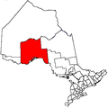 | |
|---|---|---|
| Towns | ||
| Townships | ||
| First Nations |
| |
| Indian reserves |
| |
| Indian settlements | ||
| Unorganized areas | ||
| Local services boards | ||
| Ghost towns | ||
| ||
This article is issued from Wikipedia - version of the 2/15/2016. The text is available under the Creative Commons Attribution/Share Alike but additional terms may apply for the media files.