Têt (river)
| Têt | |
|---|---|
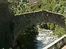 Têt near Villefranche-de-Conflent | |
| Native name | La Têt |
| Country | France |
| Basin | |
| Main source |
Pyrenees ±2,400 m (7,900 ft) |
| River mouth |
Mediterranean Sea 42°42′48″N 3°2′23″E / 42.71333°N 3.03972°ECoordinates: 42°42′48″N 3°2′23″E / 42.71333°N 3.03972°E |
| Basin size | 1,550 km2 (600 sq mi) |
| Physical characteristics | |
| Length | 116 km (72 mi) |
| Discharge |
|
The Têt (Catalan: Tet) is the largest river in Pyrénées-Orientales, southwestern France. It is 116 kilometres (72 mi) long. The Têt has its source at the foot of the Pic Carlit in the Pyrenees. It crosses the Pyrénées-Orientales département (Northern Catalonia) from West to East and ends in the Mediterranean Sea, near Perpignan (Catalan: Perpinyà).
Tributaries include
- Riberole
- Carança
- Mantet
- Rotja
- Cady
- Castellane
- Lentilla
- Boulès
- Basse
Towns along the river include
- Mont-Louis (Mont-Lluis)
- Olette (Oleta)
- Villefranche-de-Conflent (Vilafranca de Conflent)
- Prades (Prada de Conflent)
- Perpignan (Perpinyà)
- Ille-sur-Tet
References
| Wikimedia Commons has media related to Têt. |
This article is issued from Wikipedia - version of the 9/27/2016. The text is available under the Creative Commons Attribution/Share Alike but additional terms may apply for the media files.