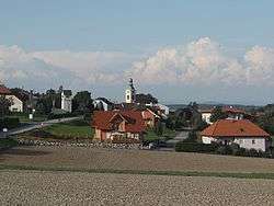
Sankt Marien
| Sankt Marien | ||
|---|---|---|
 | ||
| ||
 Sankt Marien Location within Austria | ||
| Coordinates: 48°8′47″N 14°16′32″E / 48.14639°N 14.27556°ECoordinates: 48°8′47″N 14°16′32″E / 48.14639°N 14.27556°E | ||
| Country | Austria | |
| State | Upper Austria | |
| District | Linz-Land | |
| Government | ||
| • Mayor | Helmut Templ (ÖVP) | |
| Area | ||
| • Total | 38 km2 (15 sq mi) | |
| Elevation | 338 m (1,109 ft) | |
| Population (1 January 2016)[1] | ||
| • Total | 4,645 | |
| • Density | 120/km2 (320/sq mi) | |
| Time zone | CET (UTC+1) | |
| • Summer (DST) | CEST (UTC+2) | |
| Postal code | 4502 | |
| Area code | 07227 | |
| Vehicle registration | LL | |
| Website | www.st-marien.ooe.gv.at | |

Sankt Marien is a municipality in the district Linz-Land in the Austrian state of Upper Austria.
Population
| Historical population | ||
|---|---|---|
| Year | Pop. | ±% |
| 1869 | 2,250 | — |
| 1880 | 2,218 | −1.4% |
| 1890 | 2,235 | +0.8% |
| 1900 | 2,266 | +1.4% |
| 1910 | 2,407 | +6.2% |
| 1923 | 2,432 | +1.0% |
| 1934 | 2,469 | +1.5% |
| 1939 | 2,264 | −8.3% |
| 1951 | 2,451 | +8.3% |
| 1961 | 2,388 | −2.6% |
| 1971 | 2,488 | +4.2% |
| 1981 | 2,793 | +12.3% |
| 1991 | 3,360 | +20.3% |
| 2001 | 4,140 | +23.2% |
| 2011 | 4,619 | +11.6% |
References
| Wikimedia Commons has media related to Sankt Marien. |
This article is issued from Wikipedia - version of the 11/4/2016. The text is available under the Creative Commons Attribution/Share Alike but additional terms may apply for the media files.