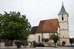
Hofkirchen im Traunkreis
| Hofkirchen im Traunkreis | ||
|---|---|---|
 | ||
| ||
 Hofkirchen im Traunkreis Location within Austria | ||
| Coordinates: 48°8′31″N 14°22′49″E / 48.14194°N 14.38028°ECoordinates: 48°8′31″N 14°22′49″E / 48.14194°N 14.38028°E | ||
| Country | Austria | |
| State | Upper Austria | |
| District | Linz-Land | |
| Government | ||
| • Mayor | Johann Lachmair (ÖVP) | |
| Area | ||
| • Total | 14 km2 (5 sq mi) | |
| Elevation | 342 m (1,122 ft) | |
| Population (1 January 2016)[1] | ||
| • Total | 1,857 | |
| • Density | 130/km2 (340/sq mi) | |
| Time zone | CET (UTC+1) | |
| • Summer (DST) | CEST (UTC+2) | |
| Postal code | 4492 | |
| Area code | 07225 | |
| Vehicle registration | LL | |
| Website | www.hofkirchen.info | |

Hofkirchen im Traunkreis is a municipality in the district Linz-Land in the Austrians state of Upper Austria.
Population
| Historical population | ||
|---|---|---|
| Year | Pop. | ±% |
| 1869 | 846 | — |
| 1880 | 874 | +3.3% |
| 1890 | 834 | −4.6% |
| 1900 | 797 | −4.4% |
| 1910 | 855 | +7.3% |
| 1923 | 791 | −7.5% |
| 1934 | 772 | −2.4% |
| 1939 | 725 | −6.1% |
| 1951 | 917 | +26.5% |
| 1961 | 873 | −4.8% |
| 1971 | 855 | −2.1% |
| 1981 | 1,030 | +20.5% |
| 1991 | 1,133 | +10.0% |
| 2001 | 1,394 | +23.0% |
| 2011 | 1,728 | +24.0% |
References
| Wikimedia Commons has media related to Hofkirchen im Traunkreis. |
This article is issued from Wikipedia - version of the 11/4/2016. The text is available under the Creative Commons Attribution/Share Alike but additional terms may apply for the media files.