San Jacinto, Masbate
| San Jacinto | ||
|---|---|---|
| Municipality | ||
| ||
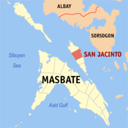 Map of Masbate with San Jacinto highlighted | ||
.svg.png) San Jacinto Location within the Philippines | ||
| Coordinates: 12°34′N 123°44′E / 12.567°N 123.733°ECoordinates: 12°34′N 123°44′E / 12.567°N 123.733°E | ||
| Country | Philippines | |
| Region | Bicol (Region V) | |
| Province | Masbate | |
| District | 1st district | |
| Barangays | 21 | |
| Government[1] | ||
| • Mayor | Nelly Altiche-Delavin | |
| Area[2] | ||
| • Total | 122.40 km2 (47.26 sq mi) | |
| Population (2010)[3] | ||
| • Total | 27,974 | |
| • Density | 230/km2 (590/sq mi) | |
| Time zone | PST (UTC+8) | |
| Zip Code | 5417 | |
| Dialing code | 56 | |

San Jacinto is a fourth class municipality in the province of Masbate, Philippines. It is located on Ticao Island. According to the 2010 census, it has a population of 27,974 people.[3]
Barangays
San Jacinto is politically subdivided into 21 barangays.[2]
- Almiñe
- Bagacay
- Bagahanglad
- Bartolabac
- Burgos
- Calipat-An
- Danao
- Dorong-an Daplian
- Interior
- Jagna-an
- Luna
- Mabini
- Piña
- District I (Pob.)
- District II (Pob.)
- District III (Pob.)
- District IV (Pob.)
- Roosevelt
- San Isidro
- Santa Rosa
- Washington
- Tacdugan
- Rizal
Demographics
| Population census of San Jacinto | ||
|---|---|---|
| Year | Pop. | ±% p.a. |
| 1990 | 23,068 | — |
| 1995 | 24,048 | +0.78% |
| 2000 | 24,780 | +0.64% |
| 2007 | 26,508 | +0.93% |
| 2010 | 27,974 | +1.98% |
| Source: National Statistics Office[3][4] | ||
References
- ↑ "Municipalities". Quezon City, Philippines: Department of the Interior and Local Government. Retrieved 20 January 2013.
- 1 2 "Province: MASBATE". PSGC Interactive. Makati City, Philippines: National Statistical Coordination Board. Retrieved 20 January 2013.
- 1 2 3 "Total Population by Province, City, Municipality and Barangay: as of May 1, 2010" (PDF). 2010 Census of Population and Housing. National Statistics Office. Retrieved 20 January 2013.
- ↑ "Province of Masbate". Municipality Population Data. LWUA Research Division. Retrieved 23 July 2013.
External links
- Philippine Standard Geographic Code
- Philippine Census Information
- Local Governance Performance Management System
 |
Monreal | | ||
| Baleno / Masbate Pass | |
Ticao Pass / Bulan, Sorsogon | ||
| ||||
| | ||||
| Masbate City / Masbate Pass | San Fernando |
Masbate City (capital) | |
| Municipalities | |
| Component city | |
This article is issued from Wikipedia - version of the 7/29/2016. The text is available under the Creative Commons Attribution/Share Alike but additional terms may apply for the media files.