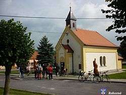
Rohozná (Jihlava District)
| Rohozná | |||
|---|---|---|---|
| Municipality | |||
 | |||
| |||
 Rohozná | |||
| Coordinates: 49°21′13″N 15°23′18″E / 49.35361°N 15.38833°ECoordinates: 49°21′13″N 15°23′18″E / 49.35361°N 15.38833°E | |||
| Country |
| ||
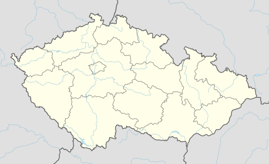
| Region | Vysočina | ||
| District | Jihlava | ||
| Area | |||
| • Total | 11.42 km2 (4.41 sq mi) | ||
| Elevation | 554 m (1,818 ft) | ||
| Population (1.1.2014) | |||
| • Total | 391 | ||
| • Density | 34/km2 (89/sq mi) | ||
| Postal code | 588 44 | ||
| Website | http://mesta.obce.cz/rohozna/ | ||
_vlajka.jpg)
_znak.jpg)
Rohozná (Czech pronunciation: [ˈroɦoznaː]) is a village and municipality (obec) in Jihlava District in the Vysočina Region of the Czech Republic.
The municipality covers an area of 11.42 square kilometres (4.41 sq mi), and has a population of 354 (as at 28 August 2006).
Rohozná lies approximately 16 kilometres (10 mi) west of Jihlava and 108 km (67 mi) south-east of Prague.
References
| Wikimedia Commons has media related to Rohozná (Jihlava District). |
This article is issued from Wikipedia - version of the 4/7/2016. The text is available under the Creative Commons Attribution/Share Alike but additional terms may apply for the media files.