Rifle Range, Queensland
| Rifle Range Somerset Region, Queensland | |||||||||||||
|---|---|---|---|---|---|---|---|---|---|---|---|---|---|
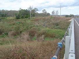 Lockyer Creek bridge along Forest Hill Fernvale Road, 2011 | |||||||||||||
| Postcode(s) | 4311 | ||||||||||||
| LGA(s) | Somerset Region | ||||||||||||
| State electorate(s) | Ipswich West | ||||||||||||
| Federal Division(s) | Dickson | ||||||||||||
| |||||||||||||
Rifle Range is a rural suburb of Somerset Region, Queensland, Australia.[1] Lockyer Creek marks the suburbs southern and western boundary.
References
- ↑ "Rifle Range (entry 44911)". Queensland Place Names. Queensland Government. Retrieved 30 June 2015.
Coordinates: 27°27′S 152°32′E / 27.450°S 152.533°E
This article is issued from Wikipedia - version of the 7/17/2016. The text is available under the Creative Commons Attribution/Share Alike but additional terms may apply for the media files.