Resiutta
| Resiutta | |
|---|---|
| Comune | |
| Comune di Resiutta | |
 Resiutta Location of Resiutta in Italy | |
| Coordinates: 46°24′N 13°13′E / 46.400°N 13.217°ECoordinates: 46°24′N 13°13′E / 46.400°N 13.217°E | |
| Country | Italy |
| Region | Friuli-Venezia Giulia |
| Province / Metropolitan city | Province of Udine (UD) |
| Frazioni | Povici |
| Government | |
| • Mayor | Francesco Nesich (Civic Party) |
| Area | |
| • Total | 20.36 km2 (7.86 sq mi) |
| Elevation | 316 m (1,037 ft) |
| Population (Jan. 2015) | |
| • Total | 311 |
| • Density | 15/km2 (40/sq mi) |
| Demonym(s) | Resiuttani |
| Time zone | CET (UTC+1) |
| • Summer (DST) | CEST (UTC+2) |
| Postal code | 33010 |
| Dialing code | 0433 |
| Patron saint | Martin of Tours |
| Saint day | November 11 |
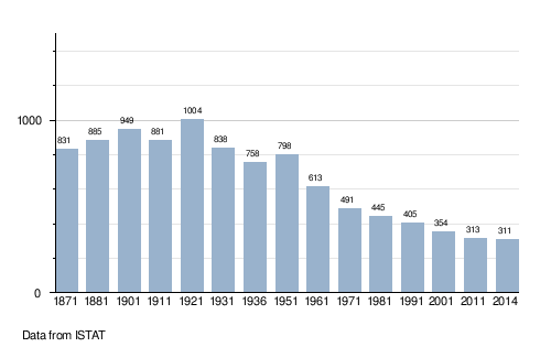
Resiutta (Friulian: Resiùte, Slovene: Na Bili) is a comune (municipality) in the Province of Udine in the Italian region Friuli-Venezia Giulia, located about 100 kilometres (62 mi) northwest of Trieste and about 35 kilometres (22 mi) north of Udine. As of 31 December 2014, it had a population of 311 and an area of 20.0 square kilometres (7.7 sq mi).[1]
The municipality of Resiutta contains the frazione Povici.
Resiutta borders the following municipalities: Chiusaforte, Moggio Udinese, Resia, Venzone.
Demographic evolution
Gallery
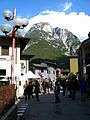 At the center
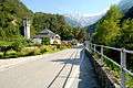 Parish church Saint Martin
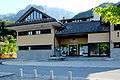 Municipio
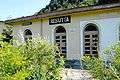 Defunct station of the old railway
References
| Wikimedia Commons has media related to Resiutta. |
This article is issued from Wikipedia - version of the 12/8/2015. The text is available under the Creative Commons Attribution/Share Alike but additional terms may apply for the media files.