R477 road (Ireland)
| |
|---|---|
|
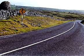
The R477 southwest of Black Head. | |
| Route information | |
| Length: | 28.7 km (17.8 mi) |
| Major junctions | |
| From: |
|
|
Passes through Murroogh Crosses Caher River Passes through Fanore | |
| To: |
|
| Road network | |

The R477 road is a regional road in Ireland, located in coastal County Clare.[1][2][3] It is a notable scenic route.[4]
References
Coordinates: 53°05′47″N 9°18′15″W / 53.096405°N 9.304141°W
This article is issued from Wikipedia - version of the 2/3/2016. The text is available under the Creative Commons Attribution/Share Alike but additional terms may apply for the media files.