Quemado, New Mexico
| Quemado, New Mexico | |
|---|---|
| Census-designated place | |
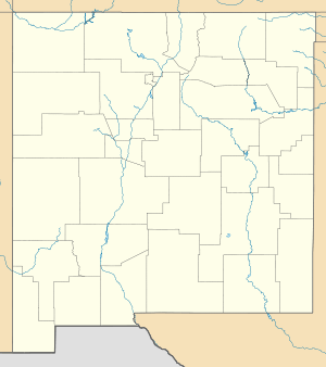 Quemado Location within the state of New Mexico | |
| Coordinates: 34°20′38″N 108°29′44″W / 34.34389°N 108.49556°WCoordinates: 34°20′38″N 108°29′44″W / 34.34389°N 108.49556°W[1] | |
| Country | United States |
| State | New Mexico |
| County | Catron |
| Area | |
| • Total | 1.80 sq mi (4.66 km2) |
| • Land | 1.79 sq mi (4.64 km2) |
| • Water | 0.01 sq mi (0.03 km2) |
| Population (2010) | |
| • Total | 228 |
| • Density | 127/sq mi (49.2/km2) |
| Time zone | Mountain (MST) (UTC-5) |
| • Summer (DST) | MDT (UTC) |
| Area code(s) | 575 |
Quemado is a census-designated place in Catron County, New Mexico, United States. As of the 2010 census it had a population of 228.[2] Walter De Maria's 1977 art installation, The Lightning Field, is between Quemado and Pie Town, New Mexico.
Jerry D. Thompson, historian of the American Southwest, was reared in Quemado.
References
- ↑ U.S. Geological Survey Geographic Names Information System: Quemado, New Mexico
- ↑ "Geographic Identifiers: 2010 Demographic Profile Data (G001): Quemado CDP, New Mexico". U.S. Census Bureau, American Factfinder. Retrieved October 16, 2014.
Further reading
- (1989) "Nobody's a Stranger in Quemado," New Mexico Magazine 67:3, March.
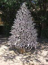
Antler tree in Quemado, 2006
Municipalities and communities of Catron County, New Mexico, United States | ||
|---|---|---|
| Village | 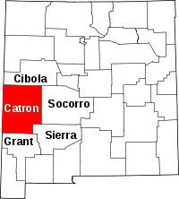 | |
| CDPs | ||
| Other unincorporated communities | ||
| Ghost towns |
| |
This article is issued from Wikipedia - version of the 6/19/2016. The text is available under the Creative Commons Attribution/Share Alike but additional terms may apply for the media files.