Pinili
| Pinili | ||
|---|---|---|
| Municipality | ||
| ||
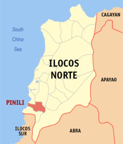 Map of Ilocos Norte showing the location of Pinili | ||
.svg.png) Pinili Location within the Philippines | ||
| Coordinates: 17°57′14″N 120°31′37″E / 17.95389°N 120.52694°ECoordinates: 17°57′14″N 120°31′37″E / 17.95389°N 120.52694°E | ||
| Country | Philippines | |
| Region | Ilocos (Region I) | |
| Province | Ilocos Norte | |
| District | 2nd District | |
| Barangays | 25 | |
| Government[1] | ||
| • Mayor | Samuel S. Pagdilao, Sr. | |
| Area[2] | ||
| • Total | 89.48 km2 (34.55 sq mi) | |
| Population (2010)[3] | ||
| • Total | 16,732 | |
| • Density | 190/km2 (480/sq mi) | |
| Time zone | PST (UTC+8) | |
| ZIP code | 2905 | |
| Dialing code | 77 | |
| Income class | 4th class; rural | |

Pinili is a 4th class municipality in the province of Ilocos Norte, Philippines. According to the 2010 census, it has a population of 16,732 people.[3]
The place is called Pinili because Gregorio Aglipay, founder of the Philippine Independent Church, chose (pinili in Tagalog) to hide in this mountainous municipality. Aglipay has a statue in honor of him, having a bible and a revolver in his hands.
Barangays
Pinili is politically subdivided into 25 barangays.[2]
- Aglipay
- Apatut-Lubong
- Badio
- Barbar
- Buanga
- Bulbulala
- Bungro
- Cabaroan
- Capangdanan
- Dalayap
- Darat
- Gulpeng
- Liliputen
- Lumbaan-Bicbica
- Nagtrigoan
- Pagdilao (Pob.)
- Pugaoan
- Puritac
- Sacritan
- Salanap
- Santo Tomas
- Tartarabang
- Puzol
- Upon
- Valbuena (Pob.)
Demographics
| Population census of Pinili | ||
|---|---|---|
| Year | Pop. | ±% p.a. |
| 1990 | 14,950 | — |
| 1995 | 14,817 | −0.17% |
| 2000 | 15,903 | +1.53% |
| 2007 | 16,185 | +0.24% |
| 2010 | 16,732 | +1.22% |
| Source: National Statistics Office[3][4] | ||
References
- ↑ "Official City/Municipal 2013 Election Results". Intramuros, Manila, Philippines: Commission on Elections (COMELEC). 11 September 2013. Retrieved 26 September 2013.
- 1 2 "Province: ILOCOS NORTE". PSGC Interactive. Makati City, Philippines: National Statistical Coordination Board. Retrieved 26 September 2013.
- 1 2 3 "Total Population by Province, City, Municipality and Barangay: as of May 1, 2010" (PDF). 2010 Census of Population and Housing. National Statistics Office. Retrieved 26 September 2013.
- ↑ "Province of Ilocos Norte". Municipality Population Data. LWUA Research Division. Retrieved 25 September 2013.
External links
- Pasyalan Ilocos Norte
- Philippine Standard Geographic Code
- Philippine Census Information
- Local Governance Performance Management System
 |
Currimao / Batac | | ||
| South China Sea | |
Nueva Era | ||
| ||||
| | ||||
| Badoc |
Laoag (capital) | |
| Municipalities | |
| Component cities | |
| Barangays | |
This article is issued from Wikipedia - version of the 7/29/2016. The text is available under the Creative Commons Attribution/Share Alike but additional terms may apply for the media files.