Paspardo
| Paspardo Pahpàrt | |
|---|---|
| Comune | |
| Comune di Paspardo | |
|
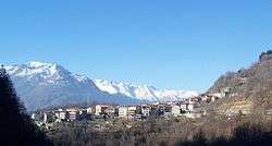
Paspardo's panorama | |
 Paspardo Location of Paspardo in Italy | |
| Coordinates: 46°01′54″N 10°22′19″E / 46.03167°N 10.37194°ECoordinates: 46°01′54″N 10°22′19″E / 46.03167°N 10.37194°E | |
| Country | Italy |
| Region | Lombardy |
| Province / Metropolitan city | Brescia (BS) |
| Area | |
| • Total | 10 km2 (4 sq mi) |
| Elevation | 978 m (3,209 ft) |
| Population (2011)[1] | |
| • Total | 650 |
| • Density | 65/km2 (170/sq mi) |
| Demonym(s) | Paspardesi |
| Time zone | CET (UTC+1) |
| • Summer (DST) | CEST (UTC+2) |
| Postal code | 25050 |
| Dialing code | 0364 |
| Patron saint | San Gaudenzio |
| Saint day | 16 August |
| Website | Official website |
Paspardo (Pahpàrt in camunian dialect) is a comune in the province of Brescia, in Lombardy. It is situated in Val Camonica. Neighbouring communes are Capo di Ponte, Cedegolo and Cimbergo.
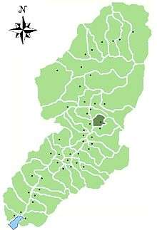
Location of Paspardo in Val Camonica
| Wikimedia Commons has media related to Paspardo. |
References
This article is issued from Wikipedia - version of the 5/31/2015. The text is available under the Creative Commons Attribution/Share Alike but additional terms may apply for the media files.