Durham Parish, New Brunswick
| Durham | |
|---|---|
| Parish | |
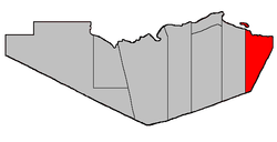 Location within Restigouche County. | |
| Coordinates: 47°52′N 66°04′W / 47.86°N 66.07°W | |
| Country |
|
| Province |
|
| County | Restigouche |
| Established | 1839 |
| Area[1] | |
| • Land | 411.10 km2 (158.73 sq mi) |
| Population (2011)[1] | |
| • Total | 1,207 |
| • Density | 2.9/km2 (8/sq mi) |
| • Pop 2006-2011 |
|
| • Dwellings | 611 |
| Time zone | AST (UTC-4) |
| • Summer (DST) | ADT (UTC-3) |
Durham is a Canadian parish in Restigouche County, New Brunswick.[2]
Delineation
Durham Parish is defined in the Territorial Division Act[3] as being bounded:
- East and south by the County lines; west by Colborne Parish, and north by Chaleur Bay including all the islands in front.[lower-alpha 1]
Communities
Parish population total does not include incorporated municipalities (in bold or italics).
Demographics
Population
| Canada census – Durham Parish, New Brunswick community profile | |||
|---|---|---|---|
| 2011 | 2006 | 2001 | |
| Population: | 1,207 (-7.4% from 2006) | 1,303 (-12.6% from 2001) | 1,491 (-8.1% from 1996) |
| Land area: | 411.10 km2 (158.73 sq mi) | 410.28 km2 (158.41 sq mi) | 410.25 km2 (158.40 sq mi) |
| Population density: | 2.9/km2 (7.5/sq mi) | 3.2/km2 (8.3/sq mi) | 3.6/km2 (9.3/sq mi) |
| Median age: | 51.3 (M: 51.6, F: 51.0) | 47.1 (M: 47.4, F: 47.0) | 41.2 (M: 41.6, F: 40.9) |
| Total private dwellings: | 611 | 640 | 657 |
| Median household income: | $.N/A | $28,192 | $24,045 |
| References: 2011[1] 2006[4] 2001[5] | |||
| Historical Census Data - Durham Parish, New Brunswick[6] | ||||||||||||||||||||||||||
|---|---|---|---|---|---|---|---|---|---|---|---|---|---|---|---|---|---|---|---|---|---|---|---|---|---|---|
|
|
| ||||||||||||||||||||||||
Language
| Canada Census Mother Tongue - Durham Parish, New Brunswick[6] | ||||||||||||||||||
|---|---|---|---|---|---|---|---|---|---|---|---|---|---|---|---|---|---|---|
| Census | Total | English |
French |
English & French |
Other | |||||||||||||
| Year | Responses | Count | Trend | Pop % | Count | Trend | Pop % | Count | Trend | Pop % | Count | Trend | Pop % | |||||
| 2011 |
1,210 |
905 | |
74.79% | 265 | |
21.90% | 35 | |
2.89% | 5 | |
0.41% | |||||
| 2006 |
1,300 |
1,055 | |
81.15% | 220 | |
16.92% | 15 | |
1.15% | 10 | |
0.77% | |||||
| 2001 |
1,495 |
1,140 | |
76.25% | 330 | |
22.07% | 25 | |
1.67% | 0 | |
0.00% | |||||
| 1996 |
1,605 |
1,145 | n/a | 71.34% | 425 | n/a | 26.48% | 35 | n/a | 2.18% | 0 | n/a | 0.00% | |||||
Access Routes
Highways and numbered routes that run through the parish, including external routes that start or finish at the parish limits:[7]
See also
Footnotes
- ↑ Heron Island is explicitly part of Colborne Parish.
References
- 1 2 3 2011 Statistics Canada Census Profile: Durham Parish, New Brunswick
- ↑ New Brunswick Provincial Archives - Durham Parish
- ↑ "Territorial Division Act (R.S.N.B. 1973, c. T-3)". Government of New Brunswick website. Retrieved 19 August 2016.
- ↑ "2006 Community Profiles". Canada 2006 Census. Statistics Canada. March 30, 2011. Retrieved 2014-03-19.
- ↑ "2001 Community Profiles". Canada 2001 Census. Statistics Canada. February 17, 2012. Retrieved 2014-03-19.
- 1 2 Statistics Canada: 1996, 2001, 2006, 2011 census
- ↑ Atlantic Canada Back Road Atlas ISBN 978-1-55368-618-7 Pages 6-7, 15
 |
Chaleur Bay | | ||
| Colborne Parish | |
Chaleur Bay | ||
| ||||
| | ||||
| Bathurst Parish (Gloucester County) |
Beresford Parish (Gloucester County) |
| Subdivisions | |
|---|---|
| Cities | |
| Counties | |
| |
Coordinates: 47°51′36″N 66°04′12″W / 47.86000°N 66.07000°W
This article is issued from Wikipedia - version of the 8/19/2016. The text is available under the Creative Commons Attribution/Share Alike but additional terms may apply for the media files.