Opegoi, California
Coordinates: 41°15′34″N 123°36′22″W / 41.25944°N 123.60611°W
| Opegoi | |
|---|---|
| Former settlement | |
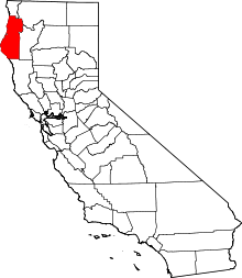
 Opegoi Location in California | |
| Coordinates: 41°15′34″N 123°36′22″W / 41.25944°N 123.60611°W | |
| Country | United States |
| State | California |
| County | Humboldt County |
| Elevation[1] | 341 ft (104 m) |
Opegoi (also, Op-pe-o, Oppe-yoh, Oppegach, Oppegoeh, Redcaps, Up-pa-goine, Up-pa-goines, and Up-pah-goines) is a former Karok settlement in Humboldt County, California.[1] It was located on the Klamath River opposite the mouth of Red Cap Creek, at an elevation of 341 feet (104 m).[1]
References
This article is issued from Wikipedia - version of the 11/20/2016. The text is available under the Creative Commons Attribution/Share Alike but additional terms may apply for the media files.