Niederer Fläming
| Niederer Fläming | |
|---|---|
 Niederer Fläming | |
Location of Niederer Fläming within Teltow-Fläming district 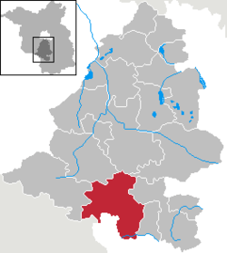 | |
| Coordinates: 51°54′N 13°12′E / 51.900°N 13.200°ECoordinates: 51°54′N 13°12′E / 51.900°N 13.200°E | |
| Country | Germany |
| State | Brandenburg |
| District | Teltow-Fläming |
| Government | |
| • Mayor | Ernst Werner (Die PARTEI) |
| Area | |
| • Total | 185.36 km2 (71.57 sq mi) |
| Population (2015-12-31)[1] | |
| • Total | 3,160 |
| • Density | 17/km2 (44/sq mi) |
| Time zone | CET/CEST (UTC+1/+2) |
| Postal codes | 14913 |
| Dialling codes | 033746 |
| Vehicle registration | TF |
| Website | www.gemeinde-niederer-flaeming.de |
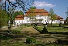
Palace in Wiepersdorf
Niederer Fläming is a municipality in the Teltow-Fläming district of Brandenburg, Germany.
Demography
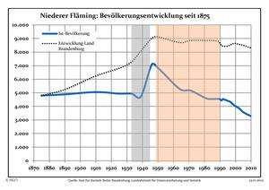 Development of Population since 1875 within the Current Boundaries (Blue Line: Population; Dotted Line: Comparison to Population Development of Brandenburg state; Grey Background: Time of Nazi rule; Red Background: Time of Communist rule)
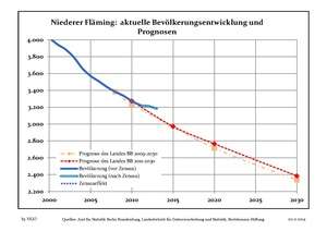 Recent Population Development (Blue Line) and Forecasts
References
Towns and municipalities in Teltow-Fläming | ||
|---|---|---|
This article is issued from Wikipedia - version of the 7/15/2015. The text is available under the Creative Commons Attribution/Share Alike but additional terms may apply for the media files.