New Troy, Michigan
| New Troy, Michigan | |
|---|---|
| Census-designated place & Unincorporated community | |
 New Troy | |
| Coordinates: 41°52′34″N 86°32′59″W / 41.87611°N 86.54972°WCoordinates: 41°52′34″N 86°32′59″W / 41.87611°N 86.54972°W | |
| Country | United States |
| State | Michigan |
| County | Berrien |
| Township | Weesaw Township |
| Area | |
| • Total | 1.3 sq mi (3.4 km2) |
| • Land | 1.3 sq mi (3.4 km2) |
| • Water | 0 sq mi (0 km2) |
| Elevation | 643 ft (196 m) |
| Population (2010) | |
| • Total | 497 |
| • Density | 375/sq mi (144.9/km2) |
| Time zone | Eastern (EST) (UTC-5) |
| • Summer (DST) | EDT (UTC-4) |
| FIPS code | 26-57660[1] |
| GNIS feature ID | 0633343[2] |
New Troy is an unincorporated community and census-designated place in Berrien County in the U.S. state of Michigan. The population was 497 at the 2010 census.[3]
Geography
The community is located on the north side of the Galien River in the northwestern part of Weesaw Township, about 6 miles (10 km) south of Bridgman.
According to the United States Census Bureau, the CDP has a total area of 1.3 square miles (3.4 km2), of which 0.0019 square miles (0.005 km2), or 0.14%, is water.[3]
References
- ↑ "American FactFinder". United States Census Bureau. Retrieved 2008-01-31.
- ↑ U.S. Geological Survey Geographic Names Information System: New Troy, Michigan
- 1 2 "Geographic Identifiers: 2010 Demographic Profile Data (G001): New Troy CDP, Michigan". U.S. Census Bureau, American Factfinder. Retrieved January 13, 2014.
Municipalities and communities of Berrien County, Michigan, United States | ||
|---|---|---|
| Cities | 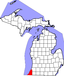 | |
| Villages | ||
| Charter townships | ||
| General law townships | ||
| CDPs | ||
| Other unincorporated communities | ||
| Footnotes | ‡This populated place also has portions in an adjacent county or counties | |
This article is issued from Wikipedia - version of the 7/30/2014. The text is available under the Creative Commons Attribution/Share Alike but additional terms may apply for the media files.