Mohawk, West Virginia
| Mohawk | |
|---|---|
| Unincorporated community | |
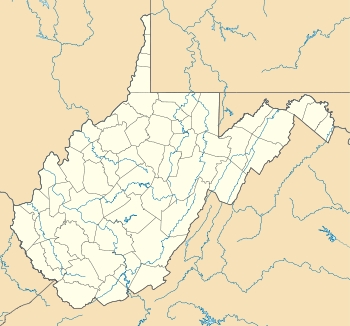 Mohawk  Mohawk Location within the state of West Virginia | |
| Coordinates: 37°30′17″N 81°54′54″W / 37.50472°N 81.91500°WCoordinates: 37°30′17″N 81°54′54″W / 37.50472°N 81.91500°W | |
| Country | United States |
| State | West Virginia |
| County | McDowell |
| Elevation | 1,010 ft (310 m) |
| Time zone | Eastern (EST) (UTC-5) |
| • Summer (DST) | EDT (UTC-4) |
| ZIP code | 24862[1] |
| Area code(s) | 304 & 681 |
| GNIS feature ID | 1689167[2] |
Mohawk is an unincorporated community in McDowell County, West Virginia, United States. Mohawk is 6 miles (9.7 km) west-northwest of Iaeger. Mohawk had a post office, which opened on December 8, 1903, and closed on June 27, 2009.[3] The community was named after the Mohawk Indians.[4][5]
References
- ↑ United States Postal Service (2012). "USPS - Look Up a ZIP Code". Retrieved 2012-02-15.
- ↑ U.S. Geological Survey Geographic Names Information System: Mohawk, West Virginia
- ↑ "Postmaster Finder - Post Offices by ZIP Code". United States Postal Service. Retrieved September 26, 2011.
- ↑ Mockridge, Norton (Apr 22, 1971). "West Virginia Takes Name Prize". Toledo Blade. p. 29. Retrieved 21 May 2015.
- ↑ Kenny, Hamill (1945). West Virginia Place Names: Their Origin and Meaning, Including the Nomenclature of the Streams and Mountains. Piedmont, WV: The Place Name Press. p. 423.
Municipalities and communities of McDowell County, West Virginia, United States | ||
|---|---|---|
| Cities | 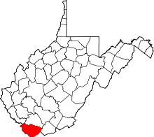 | |
| Towns | ||
| CDPs | ||
| Unincorporated communities |
| |
| Ghost town | ||
| Footnotes | ‡This populated place also has portions in an adjacent county or counties | |
This article is issued from Wikipedia - version of the 7/28/2016. The text is available under the Creative Commons Attribution/Share Alike but additional terms may apply for the media files.