Mesquite, California
Coordinates: 33°01′17″N 115°06′30″W / 33.02139°N 115.10833°W
| Mesquite | |
|---|---|
| Unincorporated community | |
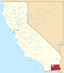
 Mesquite  Mesquite Location in California | |
| Coordinates: 33°01′17″N 115°06′30″W / 33.02139°N 115.10833°W | |
| Country | United States |
| State | California |
| County | Imperial County |
| Elevation[1] | 299 ft (91 m) |
Mesquite is an unincorporated community in Imperial County, California.[1] It is located on the Union Pacific (formerly Southern Pacific) railroad 3 miles (4.8 km) northwest of Glamis,[2] at an elevation of 299 feet (91 m).[1] It lends its name to the nearby Mesquite Mine.
References
This article is issued from Wikipedia - version of the 7/5/2016. The text is available under the Creative Commons Attribution/Share Alike but additional terms may apply for the media files.