Masaki, Ehime
| Masaki 松前町 | |
|---|---|
| Town | |
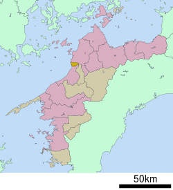 Location of Masaki in Ehime Prefecture | |
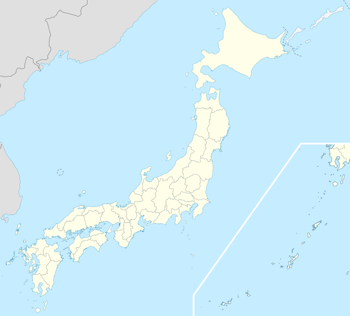 Masaki Location in Japan | |
| Coordinates: 33°47′N 132°43′E / 33.783°N 132.717°ECoordinates: 33°47′N 132°43′E / 33.783°N 132.717°E | |
| Country | Japan |
| Region | Shikoku |
| Prefecture | Ehime Prefecture |
| District | Iyo |
| Government | |
| • Mayor | Katsuya Shiraishi |
| Area | |
| • Total | 19.66 km2 (7.59 sq mi) |
| Population (March 1, 2007) | |
| • Total | 31,560 |
| • Density | 1,605.29/km2 (4,157.7/sq mi) |
| Symbols | |
| • Tree | pine (松 Matsu) |
| • Flower | sunflower (向日葵 Himawari) |
| Time zone | Japan Standard Time (UTC+9) |
| City hall address |
6-3-1 Tsutsui, Masaki-chō, Iyo-gun, Ehime-ken 791-3192 |
| Website |
www |
Masaki (松前町 Masaki-chō) is a town located in Iyo District, Ehime Prefecture, Japan.
As of March 1, 2007, the town has an estimated population of 31,560 and a density of 1,605.29 persons per km². The total area is 19.66 km².
Points of interest
External links
 Media related to Masaki, Ehime at Wikimedia Commons
- Masaki official website (Japanese)
| Core city | ||
|---|---|---|
| Cities | ||
| Iyo District | ||
| Kitauwa District | ||
| Nishiuwa District | ||
| Kamiukena District | ||
| Minamiuwa District | ||
| Ochi District | ||
| Kita District | ||
This article is issued from Wikipedia - version of the 11/8/2015. The text is available under the Creative Commons Attribution/Share Alike but additional terms may apply for the media files.