Lewis, Vermont
| Lewis, Vermont | |
|---|---|
| Town | |
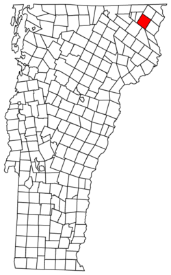 Located in Essex County, Vermont | |
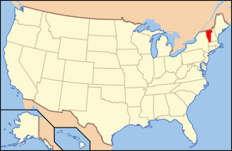 Location of Vermont with the U.S.A. | |
| Country | United States |
| State | Vermont |
| Government | |
| • Type | Unincorporated Town |
| Area | |
| • Total | 39.7 sq mi (103 km2) |
| • Land | 39.6 sq mi (103 km2) |
| • Water | 0.1 sq mi (0.3 km2) |
| Population (2010) | |
| • Total | 0 |
| • Households | 0 |
| • Families | 0 |
| Time zone | EST (UTC-5) |
| • Summer (DST) | EDT (UTC-4) |
Lewis is a town located in Essex County, Vermont. The town was named for landholders Nathan, Sevignior and Timothy Lewis.[1] Although incorporated by the state, the town was never formally organized since it never gained a sufficiently large permanent population. Since the 1910 census, the town has had a total population of zero. It last reported a population of 8 in 1900 census. The town's affairs are handled by the Unified Towns & Gores Of Essex County.
Geography
According to the United States Census Bureau, the town has a total area of 39.7 square miles (102.7 km2), of which 39.6 square miles (102.5 km2) is land and 0.1 square mile (0.3 km2) is water, for a total of 0.25% water.
 |
Avery's Gore | Avery's Gore | Averill | |
| Brighton | |
Lemington | ||
| ||||
| | ||||
| Ferdinand | Brunswick | Bloomfield |
| Historical population | |||
|---|---|---|---|
| Census | Pop. | %± | |
| 1900 | 8 | — | |
| Est. 2014 | 0 | [2] | |
| U.S. Decennial Census[3] | |||
References
- ↑ "Profile for Lewis, Vermont". ePodunk. Retrieved 2010-05-09.
- ↑ "Annual Estimates of the Resident Population for Incorporated Places: April 1, 2010 to July 1, 2014". Retrieved June 4, 2015.
- ↑ "U.S. Decennial Census". United States Census Bureau. Retrieved May 16, 2015.
External links
Coordinates: 44°52′20″N 71°44′27″W / 44.87222°N 71.74083°W
Municipalities and communities of Essex County, Vermont, United States | ||
|---|---|---|
| Towns | 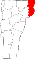 | |
| CDPs | ||
| Grants and gores | ||
| Footnotes | ‡ Unorganized | |
This article is issued from Wikipedia - version of the 8/7/2015. The text is available under the Creative Commons Attribution/Share Alike but additional terms may apply for the media files.