Le Tignet
| Le Tignet | ||
|---|---|---|
|
A view of the village of Le Tignet from a property on the path of Léouvière | ||
| ||
 Le Tignet | ||
|
Location within Provence-A.-C.d'A. region 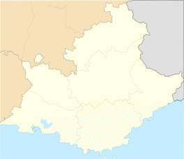 Le Tignet | ||
| Coordinates: 43°38′29″N 6°50′47″E / 43.6414°N 6.8464°ECoordinates: 43°38′29″N 6°50′47″E / 43.6414°N 6.8464°E | ||
| Country | France | |
| Region | Provence-Alpes-Côte d'Azur | |
| Department | Alpes-Maritimes | |
| Arrondissement | Grasse | |
| Canton | Saint-Vallier-de-Thiey | |
| Government | ||
| • Mayor (2008–2014) | Jacques Dominique Begard | |
| Area1 | 11.26 km2 (4.35 sq mi) | |
| Population (2008)2 | 3,099 | |
| • Density | 280/km2 (710/sq mi) | |
| Time zone | CET (UTC+1) | |
| • Summer (DST) | CEST (UTC+2) | |
| INSEE/Postal code | 06140 / 06530 | |
| Elevation |
30–600 m (98–1,969 ft) (avg. 325 m or 1,066 ft) | |
|
1 French Land Register data, which excludes lakes, ponds, glaciers > 1 km² (0.386 sq mi or 247 acres) and river estuaries. 2 Population without double counting: residents of multiple communes (e.g., students and military personnel) only counted once. | ||


Le Tignet is a commune in the Alpes-Maritimes department in the Provence-Alpes-Côte d'Azur region of south-eastern France.
The inhabitants of the commune are known as Tignétans.
Population
| Historical population | ||
|---|---|---|
| Year | Pop. | ±% |
| 1962 | 267 | — |
| 1968 | 397 | +48.7% |
| 1975 | 643 | +62.0% |
| 1982 | 1,123 | +74.7% |
| 1990 | 1,945 | +73.2% |
| 1999 | 2,763 | +42.1% |
| 2008 | 3,099 | +12.2% |
See also
References
| Wikimedia Commons has media related to Le Tignet. |
This article is issued from Wikipedia - version of the 3/9/2016. The text is available under the Creative Commons Attribution/Share Alike but additional terms may apply for the media files.