Langoëlan
| Langoëlan Lanwelan | |
|---|---|
|
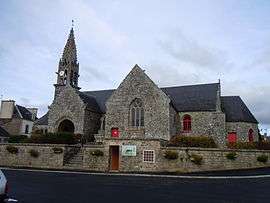
The church of Saint-Barnabé, in Langoëlan | |
 Langoëlan | |
|
Location within Brittany region 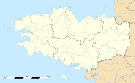 Langoëlan | |
| Coordinates: 48°07′19″N 3°13′59″W / 48.1219°N 3.2331°WCoordinates: 48°07′19″N 3°13′59″W / 48.1219°N 3.2331°W | |
| Country | France |
| Region | Brittany |
| Department | Morbihan |
| Arrondissement | Pontivy |
| Canton | Guémené-sur-Scorff |
| Intercommunality | Pays du Roi Morvan |
| Government | |
| • Mayor (2008—2014) | Florence Le Beller |
| Area1 | 22.27 km2 (8.60 sq mi) |
| Population (1999)2 | 369 |
| • Density | 17/km2 (43/sq mi) |
| Time zone | CET (UTC+1) |
| • Summer (DST) | CEST (UTC+2) |
| INSEE/Postal code | 56099 / 56160 |
| Elevation | 137–274 m (449–899 ft) |
|
1 French Land Register data, which excludes lakes, ponds, glaciers > 1 km² (0.386 sq mi or 247 acres) and river estuaries. 2 Population without double counting: residents of multiple communes (e.g., students and military personnel) only counted once. | |
Langoëlan (Breton: Lanwelan) is a commune in the Morbihan department of Brittany in north-western France.
Demographics
Inhabitants of Langoëlan are called in French Langoëlanais.
See also
References
External links
| Wikimedia Commons has media related to Langoëlan. |
- French Ministry of Culture list for Langoëlan (French)
- Map of Langoëlan on Michelin (English)
This article is issued from Wikipedia - version of the 2/13/2015. The text is available under the Creative Commons Attribution/Share Alike but additional terms may apply for the media files.