Lac-Metei, Quebec
| Lac-Metei | |
|---|---|
| Unorganized territory | |
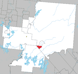 Location within La Vallée-de-l'Or RCM. | |
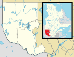 Lac-Metei Location in western Quebec. | |
| Coordinates: 47°45′N 76°23′W / 47.750°N 76.383°WCoordinates: 47°45′N 76°23′W / 47.750°N 76.383°W[1] | |
| Country |
|
| Province |
|
| Region | Abitibi-Témiscamingue |
| RCM | La Vallée-de-l'Or |
| Constituted | January 1, 1986 |
| Government[2] | |
| • Federal riding |
Abitibi—Baie-James— Nunavik—Eeyou |
| • Prov. riding | Abitibi-Est |
| Area[2][3] | |
| • Total | 78.00 km2 (30.12 sq mi) |
| • Land | 71.92 km2 (27.77 sq mi) |
| Population (2011)[3] | |
| • Total | 0 |
| • Density | 0.0/km2 (0/sq mi) |
| • Pop 2006-2011 |
|
| • Dwellings | 0 |
| Time zone | EST (UTC−5) |
| • Summer (DST) | EDT (UTC−4) |
| Highways | No major routes |
Lac-Metei is an unorganized territory in the Abitibi-Témiscamingue region of Quebec, Canada. It is one of five unorganized territories in the La Vallée-de-l'Or Regional County Municipality.
It was formed on July 6, 1996, when most of the former unorganized territory of Lac-Bricault (which was 1,038.06 square kilometres (400.80 sq mi) in area) was added to the City of Senneterre. It retained only a small wedge-shaped piece of land that was renamed to Lac-Metei.
Demographics
Population:[4]
- Population in 2011: 0
- Population in 2006: 0
- Population in 2001: 0
- Population in 1996: 0
References
- ↑ Reference number 325862 of the Commission de toponymie du Québec (French)
- 1 2 Geographic code 89908 in the official Répertoire des municipalités (French)
- 1 2 "(Code 2489908) Census Profile". 2011 census. Statistics Canada. 2012.
- ↑ Statistics Canada: 1996, 2001, 2006, 2011 census
 |
Val-d'Or | Senneterre (city), Matchi-Manitou | | |
| Réservoir-Dozois | |
Senneterre (city) | ||
| ||||
| | ||||
| Réservoir-Dozois |
| Cities | |
|---|---|
| Municipalities | |
| Parishes | |
| Unorganized territories | |
| |
This article is issued from Wikipedia - version of the 1/27/2014. The text is available under the Creative Commons Attribution/Share Alike but additional terms may apply for the media files.