Lac-Cabasta, Quebec
| Baie-Obaoca | |
|---|---|
| Unorganized territory | |
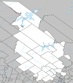 Location within Matawinie RCM. | |
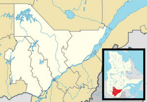 Lac-Cabasta Location in central Quebec. | |
| Coordinates: 47°32′N 74°33′W / 47.533°N 74.550°WCoordinates: 47°32′N 74°33′W / 47.533°N 74.550°W[1] | |
| Country |
|
| Province |
|
| Region | Lanaudière |
| RCM | Matawinie |
| Constituted | June 13, 1997 |
| Government[2] | |
| • Federal riding | Joliette |
| • Prov. riding | Berthier |
| Area[2][3] | |
| • Total | 7.05 km2 (2.72 sq mi) |
| • Land | 5.87 km2 (2.27 sq mi) |
| Population (2011)[3] | |
| • Total | 0 |
| • Density | 0.0/km2 (0/sq mi) |
| • Pop 2006-2011 |
|
| • Dwellings | 0 |
| Time zone | EST (UTC−5) |
| • Summer (DST) | EDT (UTC−4) |
| Highways | No major routes |
Lac-Cabasta is an unorganized territory in the Lanaudière region of Quebec, Canada, part of the Matawinie Regional County Municipality.
See also
References
- ↑ Reference number 335895 of the Commission de toponymie du Québec (French)
- 1 2 Geographic code 62919 in the official Répertoire des municipalités (French)
- 1 2 Statistics Canada 2011 Census - Lac-Cabasta census profile
 |
| |||
| Lac-Bazinet | |
Baie-Obaoca | ||
| ||||
| | ||||
| Municipalities | |
|---|---|
| Parishes | |
| Unorganized Territories | |
| |
This article is issued from Wikipedia - version of the 3/21/2016. The text is available under the Creative Commons Attribution/Share Alike but additional terms may apply for the media files.