Léglise
For other uses, see Léglise (disambiguation).
| Léglise | |
|---|---|
| Municipality | |
|
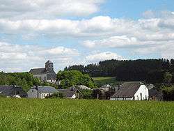
Léglise: the village and its small church | |
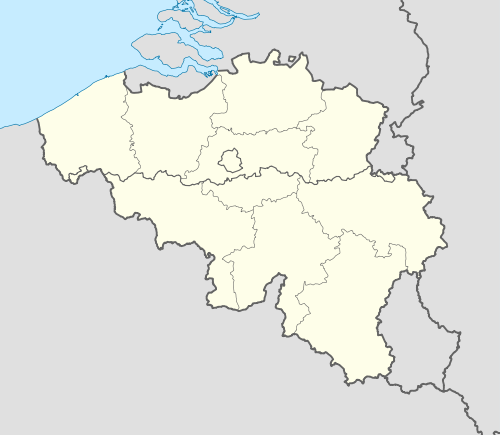 Léglise Location in Belgium | |
|
Location of Léglise in Luxembourg province 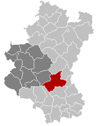 | |
| Coordinates: 49°48′N 05°32′E / 49.800°N 5.533°ECoordinates: 49°48′N 05°32′E / 49.800°N 5.533°E | |
| Country | Belgium |
| Community | French Community |
| Region | Wallonia |
| Province | Luxembourg |
| Arrondissement | Neufchâteau |
| Government | |
| • Mayor | André Lecomte |
| • Governing party/ies | H2000+ |
| Area | |
| • Total | 172.92 km2 (66.76 sq mi) |
| Population (1 January 2016)[1] | |
| • Total | 5,180 |
| • Density | 30/km2 (78/sq mi) |
| Postal codes | 6860 |
| Area codes | 063 |
| Website | www.communeleglise.be |
Léglise is a Walloon municipality of Belgium located in the province of Luxembourg. On 1 January 2007 the municipality, which covers 172.92 km², had 4,178 inhabitants, giving a population density of 24.2 inhabitants per km².
The municipality consists of the following sub-municipalities: Léglise proper, Assenois, Ébly, Mellier, and Witry. Other population centers include:
- Behême
- Bernimont
- Bombois
- Burnaimont
- Chêne
- Chevaudos
- Gennevaux
- Habaru
- Lavaux
- Les Fossés
- Louftémont
- Maisoncelle
- Narcimont
- Naleumont
- Nivelet
- Rancimont
- Thibessart
- Traimont
- Vaux-lez-Chêne
- Vlessart
- Volaiville
- Winville
- Witimont
See also
References
- ↑ Population per municipality as of 1 January 2016 (XLS; 397 KB)
External links
-
 Media related to Léglise at Wikimedia Commons
 |
Vaux-sur-Sûre | Fauvillers | | |
| Neufchâteau | |
Martelange | ||
| ||||
| | ||||
| Chiny | Tintigny, Habay |
Municipalities of Luxembourg Province | ||
|---|---|---|
| Arlon |  | |
| Bastogne | ||
| Marche-en-Famenne | ||
| Neufchâteau | ||
| Virton | ||
This article is issued from Wikipedia - version of the 12/1/2016. The text is available under the Creative Commons Attribution/Share Alike but additional terms may apply for the media files.