Juchitlán
| Juchitlán | ||
|---|---|---|
| Municipality and city | ||
| ||
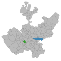 Location of the municipality in Jalisco | ||
|
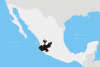
Juchitlán Location in Mexico | ||
| Coordinates: 20°04′59.07″N 104°06′00.35″W / 20.0830750°N 104.1000972°WCoordinates: 20°04′59.07″N 104°06′00.35″W / 20.0830750°N 104.1000972°W | ||
| Country |
| |
| State | Jalisco | |
| Area | ||
| • Total | 403.88 km2 (155.94 sq mi) | |
| Population (2005) | ||
| • Total | 5,282 | |
| Time zone | Central Standard Time (UTC-6) | |
| • Summer (DST) | Central Daylight Time (UTC-5) | |

Juchitlán is a town and municipality, in Jalisco in central-western Mexico. The municipality covers an area of 403.88 km².
As of 2005, the municipality had a total population of 5,282.[1]
References
- ↑ "Juchitlán". Enciclopedia de los Municipios de México. Instituto Nacional para el Federalismo y el Desarrollo Municipal. Retrieved April 16, 2009.
This article is issued from Wikipedia - version of the 2/19/2016. The text is available under the Creative Commons Attribution/Share Alike but additional terms may apply for the media files.