Hure Banner
| Hure Banner 库伦旗 • ᠬᠦᠷᠢᠶᠡᠬᠣᠰᠢᠭᠤ | |
|---|---|
| Banner | |
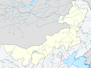 Hure Location in Inner Mongolia | |
| Coordinates: 42°44′N 121°47′E / 42.733°N 121.783°ECoordinates: 42°44′N 121°47′E / 42.733°N 121.783°E | |
| Country | People's Republic of China |
| Region | Inner Mongolia |
| Prefecture-level city | Tongliao |
| Area | |
| • Total | 4,650 km2 (1,800 sq mi) |
| Elevation | 261 m (856 ft) |
| Population | |
| • Total | 170,000 |
| • Density | 37/km2 (95/sq mi) |
| Time zone | China Standard (UTC+8) |
| Postal code | 028200 |
| Area code(s) | 0475 |
| Website | http://www.kulun.gov.cn/ |
Hure Banner (Mongolian: ᠬᠦᠷᠢᠶᠡ ᠬᠣᠰᠢᠭᠤ Күриы-э қосиу Küriy-e qosiɣu; simplified Chinese: 库伦旗; traditional Chinese: 庫倫旗; pinyin: Kùlún Qí) is a banner of southeastern Inner Mongolia, People's Republic of China, bordering Liaoning province to the south. It is under the administration of Tongliao City, 106 kilometres (66 mi) to the north-northeast.
References
- www.xzqh.org (Chinese)
This article is issued from Wikipedia - version of the 5/27/2016. The text is available under the Creative Commons Attribution/Share Alike but additional terms may apply for the media files.