General Luna, Quezon
| General Luna | |
|---|---|
| Municipality | |
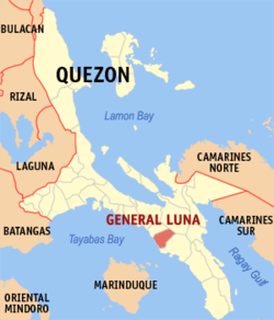 Map of Quezon showing the location of General Luna | |
.svg.png) Gen. Luna Location within the Philippines | |
| Coordinates: 13°41′17″N 122°10′15″E / 13.68806°N 122.17083°ECoordinates: 13°41′17″N 122°10′15″E / 13.68806°N 122.17083°E | |
| Country | Philippines |
| Region | Calabarzon (Region IV-A) |
| Province | Quezon |
| District | 3rd district of Quezon |
| Barangays | 27 |
| Government[1] | |
| • Mayor | Jose Stevenson M. Sangalang (Lakas–CMD) |
| Area[2] | |
| • Total | 101.02 km2 (39.00 sq mi) |
| Population (2015)[3] | |
| • Total | 26,494 |
| • Density | 260/km2 (680/sq mi) |
| Time zone | PST (UTC+8) |
| ZIP code | 4310 |
| Dialing code | +63 (0)42 |
| Income class | 4th class; partially urban |
The Municipality of General Luna (Filipino: Bayan ng Heneral Luna) is a fourth class municipality in the province of Quezon, Philippines, named in honour of Antonio Luna. According to the 2015 census, it has a population of 26,494 people.[3]
Barangays
General Luna is politically subdivided into 27 barangays.[2]
- Bacong Ibaba
- Bacong Ilaya
- Barangay 1 (Pob.)
- Barangay 2 (Pob.)
- Barangay 3 (Pob.)
- Barangay 4 (Pob.)
- Barangay 5 (Pob.)
- Barangay 6 (Pob.)
- Barangay 7 (Pob.)
- Barangay 8 (Pob.)
- Barangay 9 (Pob.)
- Lavides
- Magsaysay
- Malaya
- Nieva
- Recto
- San Ignacio Ibaba
- San Ignacio Ilaya
- San Isidro Ibaba
- San Isidro Ilaya
- San Jose
- San Nicolas
- San Vicente
- Santa Maria Ibaba
- Santa Maria Ilaya
- Sumilang
- Villarica
Demographics
| Population census of General Luna | ||
|---|---|---|
| Year | Pop. | ±% p.a. |
| 1990 | 17,997 | — |
| 1995 | 20,956 | +2.89% |
| 2000 | 21,068 | +0.11% |
| 2007 | 23,379 | +1.45% |
| 2010 | 25,373 | +3.02% |
| 2015 | 26,494 | +0.83% |
| Source: Philippine Statistics Office[3] | ||
References
- ↑ "Official City/Municipal 2013 Election Results". Intramuros, Manila, Philippines: Commission on Elections (COMELEC). 11 September 2013. Retrieved 25 November 2013.
- 1 2 "Province: QUEZON". PSGC Interactive. Makati City, Philippines: National Statistical Coordination Board. Retrieved 25 November 2013.
- 1 2 3 "Highlights of the Philippine Population 2015 Census of Population". 2015 Census of Population and Housing. Philippine Statistics Office. Retrieved 26 May 2016.
External links
- Philippine Standard Geographic Code
- Philippine Census Information
- Local Governance Performance Management System
 |
Macalelon | |
Lopez | |
| Tayabas Bay | |
|||
| ||||
| | ||||
| Mongpong Pass | |
Catanauan |
Lucena (capital) | |
| Municipalities |
|
| Component city | |
| Highly urbanized city |
|
This article is issued from Wikipedia - version of the 12/1/2016. The text is available under the Creative Commons Attribution/Share Alike but additional terms may apply for the media files.