Dinalungan, Aurora
| Dinalungan | |
|---|---|
| Municipality | |
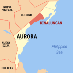 Location within Aurora province | |
.svg.png) Dinalungan Location within the Philippines | |
| Coordinates: 16°06′N 121°46′E / 16.1°N 121.77°ECoordinates: 16°06′N 121°46′E / 16.1°N 121.77°E | |
| Country | Philippines |
| Region | Central Luzon (Region III) |
| Province | Aurora |
| District | Lone District |
| Founded | June 18, 1966 |
| Barangays | 9 (see Barangays) |
| Government [1] | |
| • Type | Sangguniang Bayan |
| • Mayor | Tito T. Tubigan (Lakas–CMD) |
| Area[2] | |
| • Total | 316.85 km2 (122.34 sq mi) |
| Population (2015 census)[3] | |
| • Total | 11,322 |
| • Density | 36/km2 (93/sq mi) |
| • Voter (2016)[4] | 8,088 |
| Time zone | PST (UTC+8) |
| ZIP code | 3206 |
| IDD : area code | +63 (0)42 |
| Income class | 4th class |
| PSGC | 037704000 |
| Website |
www |
Dinalungan, officially the Municipality of Dinalungan (Filipino: Bayan ng Dinalungan), is a municipality in the province of Aurora in the Central Luzon (Region III) of the Philippines. The population was 11,322 at the 2015 census.[3] In the 2016 election, it had 8,088 registered voters.[4]
Two protected areas, the Talaytay Protected Landscape and the Simbahan-Talagas Protected Landscape, are located in the municipality.
Geography
Dinalungan is located at 16°06′N 121°46′E / 16.1°N 121.77°E.
According to the Philippine Statistics Authority, the municipality has a land area of 316.85 square kilometres (122.34 sq mi)[2] constituting 10.07% of the 3,147.32-square-kilometre- (1,215.19 sq mi) total area of Aurora.
Barangays
Dinalungan is politically subdivided into 9 barangays.[5]
| PSGC | Barangay | Population | ±% p.a. | ||
|---|---|---|---|---|---|
| 2015[3] | 2010[6] | ||||
| 037704001 | Abuleg | 10.9% | 1,236 | 1,190 | +0.72% |
| 037704002 | Zone I (Poblacion) | 16.6% | 1,881 | 1,866 | +0.15% |
| 037704003 | Zone II (Poblacion) | 14.7% | 1,666 | 1,653 | +0.15% |
| 037704004 | Nipoo (Bulo) | 8.0% | 905 | 896 | +0.19% |
| 037704005 | Dibaraybay | 11.4% | 1,292 | 1,283 | +0.13% |
| 037704006 | Ditawini | 5.8% | 659 | 686 | −0.76% |
| 037704007 | Mapalad | 6.7% | 763 | 812 | −1.18% |
| 037704008 | Paleg | 10.6% | 1,203 | 971 | +4.16% |
| 037704009 | Simbahan | 15.2% | 1,717 | 1,631 | +0.98% |
| Total | 11,322 | 10,988 | +0.57% | ||
Demographics
| Population census of Dinalungan | |||||||||||||||||||||||||
|---|---|---|---|---|---|---|---|---|---|---|---|---|---|---|---|---|---|---|---|---|---|---|---|---|---|
|
| ||||||||||||||||||||||||
| Source: PSA[3][6][7] | |||||||||||||||||||||||||
In the 2015 census, Dinalungan had a population of 11,322.[3] The population density was 36 inhabitants per square kilometre (93/sq mi).
In the 2016 election, it had 8,088 registered voters.[4]
References
- ↑ "Municipality". Quezon City, Philippines: Department of the Interior and Local Government. Retrieved 31 May 2013.
- 1 2 "Province: Aurora". PSGC Interactive. Makati City, Philippines: Philippine Statistics Authority. Retrieved 6 November 2016.
- 1 2 3 4 5 "Region III (CENTRAL LUZON)". Census of Population (2015): Total Population by Province, City, Municipality and Barangay (Report). PSA. Retrieved 20 June 2016.
- 1 2 3 "2016 National and Local Elections Statistics". Commission on Elections. 2016.
- ↑ "Municipal: Dinalungan, Aurora". PSA. Philippines: National Statistical Coordination Board. Retrieved 8 January 2016.
- 1 2 "Region III (CENTRAL LUZON)". Census of Population and Housing (2010): Total Population by Province, City, Municipality and Barangay (Report). NSO. Retrieved 29 June 2016.
- ↑ "Region III (CENTRAL LUZON)". Census of Population (1995, 2000 and 2007): Total Population by Province, City and Municipality (Report). NSO. Archived from the original on 24 June 2011.
External links
- Dinalungan on Aurora.ph
 |
Maddela, Quirino | Casiguran | | |
| Nagtipunan, Quirino | |
|||
| ||||
| | ||||
| Dipaculao | |
Baler Bay (Philippine Sea) |
Baler (capital) | |
| Municipalities | |
| Barangays | |