Dangers
For other uses, see Dangers (disambiguation).
| Dangers | |
|---|---|
 Dangers | |
|
Location within Centre-Val de Loire region 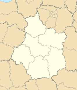 Dangers | |
| Coordinates: 48°30′34″N 1°21′04″E / 48.5094°N 1.3511°ECoordinates: 48°30′34″N 1°21′04″E / 48.5094°N 1.3511°E | |
| Country | France |
| Region | Centre-Val de Loire |
| Department | Eure-et-Loir |
| Arrondissement | Chartres |
| Canton | Courville-sur-Eure |
| Intercommunality | Communauté d'agglomération Chartres métropole |
| Government | |
| • Mayor (2008–2014) | Jean-François Morizeau |
| Area1 | 7.39 km2 (2.85 sq mi) |
| Population (2009)2 | 410 |
| • Density | 55/km2 (140/sq mi) |
| Time zone | CET (UTC+1) |
| • Summer (DST) | CEST (UTC+2) |
| INSEE/Postal code | 28128 / 28190 |
| Elevation |
182–223 m (597–732 ft) (avg. 199 m or 653 ft) |
|
1 French Land Register data, which excludes lakes, ponds, glaciers > 1 km² (0.386 sq mi or 247 acres) and river estuaries. 2 Population without double counting: residents of multiple communes (e.g., students and military personnel) only counted once. | |
Dangers is a commune in the Eure-et-Loir department in northern France.
Population
| Historical population | ||
|---|---|---|
| Year | Pop. | ±% |
| 1962 | 192 | — |
| 1968 | 209 | +8.9% |
| 1975 | 266 | +27.3% |
| 1982 | 315 | +18.4% |
| 1990 | 328 | +4.1% |
| 1999 | 382 | +16.5% |
| 2008 | 412 | +7.9% |
See also
References
| Wikimedia Commons has media related to Dangers. |
This article is issued from Wikipedia - version of the 11/13/2014. The text is available under the Creative Commons Attribution/Share Alike but additional terms may apply for the media files.