Danby, California
| Danby | |
|---|---|
| Unincorporated community | |
 Danby Location in California | |
| Coordinates: 34°38′08″N 115°20′53″W / 34.63556°N 115.34806°WCoordinates: 34°38′08″N 115°20′53″W / 34.63556°N 115.34806°W[1] | |
| Country | United States |
| State | California |
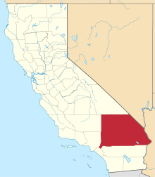
| County | San Bernardino |
| Elevation[1] | 1,345 ft (410 m) |
| Time zone | Pacific Time Zone (UTC−8) |
| • Summer (DST) | PDT (UTC−7) |
| Area codes | 442/760 |
| FIPS code | 06-17960 |
| GNIS feature ID | 252880 |
Danby is an unincorporated community in San Bernardino County, California, United States. Danby is located along the Santa Fe Railroad near historic Route 66, 9 miles (14 km) southwest of Essex.
References
- 1 2 "Danby". Geographic Names Information System. United States Geological Survey. Retrieved May 11, 2015.
This article is issued from Wikipedia - version of the 5/11/2015. The text is available under the Creative Commons Attribution/Share Alike but additional terms may apply for the media files.