D26 road (Croatia)
| |
|---|---|
| Route information | |
| Length: | 88.5 km (55.0 mi) |
| Major junctions | |
| From: |
|
|
| |
| To: |
|
| Location | |
| Counties: | Zagreb County, Bjelovar-Bilogora |
| Major cities: | Vrbovec, Čazma, Garešnica, Daruvar. |
| Highway system | |
| State roads in Croatia | |

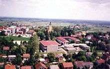
Vrbovec, near the western terminus of the D26 road
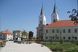
Čazma, on the D26 road route
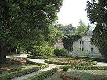
Daruvar, at the eastern terminus of the D26 road
D26 is a state road in central Croatia connecting the D5 in Daruvar and the D10 expressway near Vrbovec (Dubrava interchange),[maps 1] comprising a connection to the planned but cancelled A12 motorway route.[1][2] The road is 88.5 km (55.0 mi) long.[3]
The road, as well as all other state roads in Croatia, is managed and maintained by Hrvatske ceste, a state owned company.[4]
Traffic volume
Traffic is regularly counted and reported by Hrvatske ceste, operator of the road.[5]
| D26 traffic volume | ||||
| Road | Counting site | AADT | ASDT | Notes |
| |
2036 Konak | 2,409 | 2,444 | Adjacent to the Dubrava interchange (D10). |
| |
2111 Čazma - east | 1,524 | 1,625 | Adjacent to the L37056 junction. |
| |
2112 Trnovitički Popovac | 1,231 | 1,298 | Adjacent to the D45 junction. |
| |
2128 Garešnica | 5,155 | 5,168 | Between the Ž3165 and D45 junctions. |
| |
2211 Hrastovac | 1,302 | 1,393 | Adjacent to the Ž3168 junction. |
| |
2218 Uljanik | 1,140 | 1,196 | Adjacent to the L37145 junction. |
Road junctions and populated areas
| D26 junctions/populated areas | |
| Type | Slip roads/Notes |
| |
Dubrava interchange Ž3288 to Vrbovec, Rakovec and Sveti Ivan Zelina (D3). The western terminus of the road. |
| |
Koritna |
| |
Ladina |
| |
Dubrava Ž2211 to Cugovec, Poljana Križevačka and Cubinec (D22). Ž3401 to Ivanić Grad (to the south) and to Haganj (D28) (to the north). |
| |
Zgališće |
| |
Bađinec |
| |
Svinjarec |
| |
Donji Dragičevci |
| |
Cerina Ž3284 to Donji Lipovčani, Marčani and Sovari (D43). |
| |
Čazma Ž3128 to Rečica Kriška. |
| |
Grabovnica |
| |
Vučani |
| |
Donji Miklouš Ž3082 to Martinac and Donja Šušnjara. |
| |
Šimljanik |
| |
Gornja Garešnica Ž3131 to Gornja Jelenska and Pobrđe. |
| |
Trnovitički Popovac |
| |
Ž3084 to Begovača, Berek, Ivanska and Paljevine. |
| |
Mali Pašijan |
| |
Veliki Pašijan Ž3090 to Velika Trnovitica and Nova Rača. |
| |
The D26 and D45 are concurrent to the south. |
| |
Garešnica The D26 and D45 are concurrent to the north. Ž3136 to Tomašica and Veliki Zdenci (D5). Ž3167 to Kaniška Iva and Međurić. Ž3165 to Dišnik. |
| |
Hrastovac |
| |
Uljanik Ž3168 to Poljana, Međurić and Banova Jaruga. |
| |
Blagorodovac |
| |
Dežanovac Ž3138 to Končanica (D5). Ž3169 to Trojeglava and Badljevina (D5). Ž3281 to Kreštelovac and Sokolovac. |
| |
Ivanovo Polje |
| |
Gornji Daruvar |
| |
Daruvar Ž3287 within the city. The eastern terminus of the road. |
Maps
- ↑ Overview map of the D26 (Map). OpenStreetMap. Retrieved July 21, 2014.
Sources
- ↑ "Regulation on motorway markings, chainage, interchange/exit/rest area numbers and names". Narodne novine (in Croatian). April 24, 2003.
- ↑ Andreja Žapčić (20 June 2012). "Vlada HAC-u odobrila novi kredit od 120 milijuna eura" [Government approves a new 120 million Euro loan to the Hrvatske autoceste] (in Croatian). t-portal.hr. Retrieved 24 June 2012.
- ↑ "Decision on categorization of public roads as state roads, county roads and local roads". Narodne novine (in Croatian). February 17, 2010.
- ↑ "Public Roads Act". Narodne novine (in Croatian). December 14, 2004.
- ↑ "Brojenje prometa na cestama Republike Hrvatske godine 2015." [Traffic counting on the roadways of Croatia in 2015] (PDF) (in Croatian). Hrvatske ceste. April 2016. Retrieved 2016-06-23.
This article is issued from Wikipedia - version of the 9/8/2016. The text is available under the Creative Commons Attribution/Share Alike but additional terms may apply for the media files.