Comodoro
This article is about the Brazilian municipality. For the Argentine city, see
Comodoro Rivadavia.
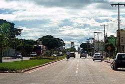
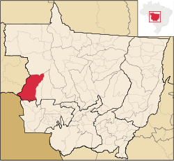
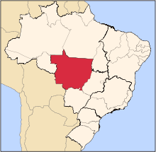
Comodoro is a municipality in the state of Mato Grosso in the Central-West Region of Brazil.[1][2][3][4]
See also
References
- ↑ "Divisão Territorial do Brasil" (in Portuguese). Divisão Territorial do Brasil e Limites Territoriais, Instituto Brasileiro de Geografia e Estatística (IBGE). July 1, 2008. Retrieved December 17, 2009.
- ↑ "Estimativas da população para 1º de julho de 2009" (PDF) (in Portuguese). Estimativas de População, Instituto Brasileiro de Geografia e Estatística (IBGE). August 14, 2009. Retrieved December 17, 2009.
- ↑ "Ranking decrescente do IDH-M dos municípios do Brasil" (in Portuguese). Atlas do Desenvolvimento Humano, Programa das Nações Unidas para o Desenvolvimento (PNUD). 2000. Archived from the original on October 3, 2009. Retrieved December 17, 2009.
- ↑ "Produto Interno Bruto dos Municípios 2002-2005" (PDF) (in Portuguese). Instituto Brasileiro de Geografia e Estatística (IBGE). December 19, 2007. Archived from the original (PDF) on October 2, 2008. Retrieved December 17, 2009.
|
|---|
|
|
|
| Centro-Sul Mato-Grossense | Alto Pantanal | |
|---|
| Alto Paraguai | |
|---|
| Cuiabá | |
|---|
| Rosario Oeste | |
|---|
| |
|---|
|
| Nordeste Mato-Grossense | Canarana | |
|---|
| Medio Araguaia | |
|---|
| Norte Araguaia | |
|---|
|
|---|
|
| Norte Mato-Grossense | Alta Floresta | |
|---|
| Alto Teles Pires | |
|---|
| Arinos | |
|---|
| Aripuanã | |
|---|
| Colíder | |
|---|
| Paranatinga | |
|---|
| Parecis | |
|---|
| Sinop | |
|---|
|
|---|
|
| Sudeste Mato-Grossense | Alto Araguaia | |
|---|
| Primavera do Leste | |
|---|
| Rondonópolis | |
|---|
| Tesouro | |
|---|
|
|---|
|
| Sudoeste Mato-Grossense | Alto Guapore | |
|---|
| Jauru | |
|---|
| Tangará da Serra | |
|---|
|
|---|
Coordinates: 13°39′S 59°47′W / 13.650°S 59.783°W / -13.650; -59.783