Colburn, Indiana
| Colburn | |
|---|---|
| Census-designated place | |
|
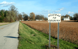
Looking east toward Colburn along County Road 700 North | |
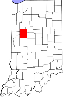 Tippecanoe County's location in Indiana | |
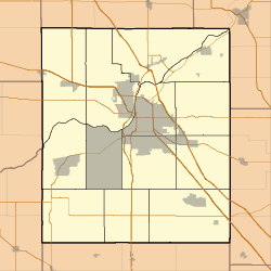 Colburn Location in Tippecanoe County | |
| Coordinates: 40°31′07″N 86°42′51″W / 40.51861°N 86.71417°WCoordinates: 40°31′07″N 86°42′51″W / 40.51861°N 86.71417°W | |
| Country | United States |
| State | Indiana |
| County | Tippecanoe |
| Township | Washington |
| Founded | 1858 |
| Founder | Jacob H. Chapman |
| Elevation[1] | 662 ft (202 m) |
| Time zone | EST (UTC-5) |
| • Summer (DST) | EDT (UTC-4) |
| Zip Code | 47905 |
| Area code(s) | 765 |
| GNIS feature ID | 432745 |
Colburn is a small unincorporated census-designated place in northeastern Washington Township, Tippecanoe County, in the U.S. state of Indiana.[2]
It is part of the Lafayette, Indiana Metropolitan Statistical Area.
History
Colburn was originally called Chapmanville.[3]
A post office was established at Colburn in 1860, and remained in operation until it was discontinued in 1988.[4]
Geography
Colburn is located at 40°31'07" North, 86°42'51" West (40.518611, -86.714167) in Washington Township, at an elevation of 662 feet. Nearby communities include Lafayette (12 miles southwest), Delphi (6 miles north), Buck Creek (4 miles south) and Americus (3.5 miles west).
References
- ↑ "US Board on Geographic Names". United States Geological Survey. October 25, 2007. Retrieved 2016-07-25.
- ↑ "Colburn, Indiana". Geographic Names Information System. United States Geological Survey. Retrieved 2016-07-25.
- ↑ "USGS detail on Colburn - Variant Citation". Retrieved 2016-07-25.
- ↑ "Tippecanoe County". Jim Forte Postal History. Retrieved July 25, 2016.
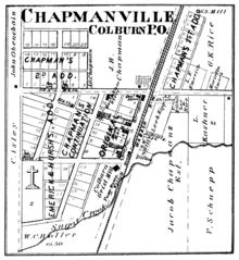
Colburn in 1878.
Municipalities and communities of Tippecanoe County, Indiana, United States | ||
|---|---|---|
| Cities | ||
| Towns | ||
| Townships | ||
| CDPs | ||
| Other unincorporated communities |
| |
| Ghost towns | ||
| Footnotes | ‡This populated place also has portions in an adjacent county or counties | |
This article is issued from Wikipedia - version of the 11/27/2016. The text is available under the Creative Commons Attribution/Share Alike but additional terms may apply for the media files.