Chindrieux
| Chindrieux | |
|---|---|
|
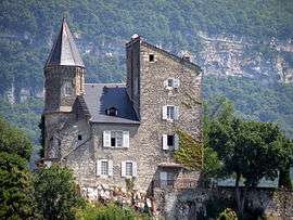
The Château de Châtillon, in Chindrieux | |
 Chindrieux | |
|
Location within Auvergne-Rhône-Alpes region  Chindrieux | |
| Coordinates: 45°49′18″N 5°51′00″E / 45.821667°N 05.85°ECoordinates: 45°49′18″N 5°51′00″E / 45.821667°N 05.85°E | |
| Country | France |
| Region | Auvergne-Rhône-Alpes |
| Department | Savoie |
| Arrondissement | Chambéry |
| Canton | Ruffieux |
| Area1 | 16.42 km2 (6.34 sq mi) |
| Population (2006)2 | 1,214 |
| • Density | 74/km2 (190/sq mi) |
| Time zone | CET (UTC+1) |
| • Summer (DST) | CEST (UTC+2) |
| INSEE/Postal code | 73085 / 73310 |
| Elevation |
227–900 m (745–2,953 ft) (avg. 284 m or 932 ft) |
|
1 French Land Register data, which excludes lakes, ponds, glaciers > 1 km² (0.386 sq mi or 247 acres) and river estuaries. 2 Population without double counting: residents of multiple communes (e.g., students and military personnel) only counted once. | |
Chindrieux is commune in the Savoie department in the Auvergne-Rhône-Alpes region in south-eastern France.
It lies near Lake Bourget.
World heritage site
It is home to one or more prehistoric pile-dwelling (or stilt house) settlements that are part of the Prehistoric Pile dwellings around the Alps UNESCO World Heritage Site.[1]
See also
References
External links
| Wikimedia Commons has media related to Chindrieux. |
This article is issued from Wikipedia - version of the 10/28/2016. The text is available under the Creative Commons Attribution/Share Alike but additional terms may apply for the media files.